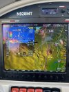
Advanced Avionics vs. Conventional instruments

Aceman

Pre-Flight
Joined
Jan 17, 2024
Messages
78
Display Name

Display name:
Aceman
I've been out of the loop on avionics for years now. I used to work on B-52 bomber aircraft avionics many years ago. I wanted to know how you guys/gals feel about advanced avionics vs. conventional. Do you think using conventional makes the pilot more proficient at the world around him and doing the old fashioned paper computations using pilotage and dead reckoning? Or is the use of GPS so wide-spread now that it's literally a requirement? Is it much easier to navigate if you had an all-in-one instrument device that gave all calculations digitally? Or is the pilot crippled by using modern avionics?
 
I feel they are a mixed blessing.

There are a lot of people who follow the magenta line and have no situational awareness.

I see it when driving. When I used maps I knew where I was, but with GPS, I know I am on course to my destination. Maybe. :D

When flying, I make sure I keep in the loop. Using the tools to plan ahead, think about the what ifs.
 
They are all tools that can be used by proficient users to various success. They can both be misused to disastrous results. Advanced tools have more features, which might be advantageous to users that can handle the extra input, but may overwhelm other users that would do better getting less data but using what they have more effectively.
 
I am a post-solo student, so there are people here with much more experience than me, however my time has been split between old buckets with conventional instruments and newer planes with EFIS.

My take is that the new displays act as a second person next to you that can help with certain tasks. The situational awareness of having ADS-B, moving map, and weather at your fingertips is pretty valuable. But it in no way absolves the pilot of his responsibility to still look for traffic, pre-plan the route and know what the weather will bring.

But I solo'd in a plane with a G3X and I'm glad I had it.
 
I would say that, while not actually required, a GPS is a very important tool. Getting into an EFIS with a nice moving map, synthetic vision, engine monitor, etc. is just a huge leap forward in safety. The situational awareness you get from a nice new EFIS is amazing. I know people were able to fly IFR safely in the past with round gauges, but the EFIS makes it much safer. The most important thing is to learn what you have well. There is a HUGE amount of information on, for example, a Dynon Skyview HDX screen. I have flown many many hours behind one, and I know exactly where all the informations is, so I know that makes me a better pilot. It is very hard to get turned around. Again, when the pilot's workload gets busy, being fluent with your equipment is the most important thing.
 
I look at it the same way as what VOR was to ADF. Or Loran was to VOR. Or GPS was to Loran. It's an improvement of the tool that we used to have. When VOR's came out I bet there were old timers who looked at anyone who relied on those newfangled navaids as sissies. You wanna call me a sissy because I didn't install an ADF in my Velocity? Fine by me.

In my mind, an EFIS is the same thing compared to a six-pack. Just a newer (and better) tool for keeping the airplane properly oriented in the sky.

I will say, however, I do think learning with a six-pack is a must because not every plane has an EFIS.
 
tnflygirl is the perfect example of where advanced equipment seems to have been more hindrance than help.
 
Having flown through the ADF, VOR, DME, LORAN, GPS progression over the past 50 years, I now feel like a passenger on an airliner, even though I'm the PIC. I take off, push a few buttons, activate the autopilot then monitor the flight and chat with controllers while I look at the scenery. For fun I just fly the Cub and tow gliders in the Pawnee, neither of which has any gadgetry. Gliders are basic fun as well.
 
Or is the pilot crippled by using modern avionics?
This sounds dangerously close to "Grumpy Old Man Syndrome":
Back in my day, the gas station gave you paper maps! And a hamburger and Coke was 35 cents! Kids these days.... Today it's all moving maps and microwave ovens and computers and nobody knows how to do anything!

There are very few folks with woodshops in their backyards today who would argue that it was better to build stuff before table saws became commonly available, even if those saws also make it easier to cut all your fingers off if you're not careful.

GPS and other modern avionics are tools. They've been widely adopted for good reason: They provide a huge benefit in the cockpit when properly used. But like all tools, harm can result from misuse. It's up to the user.
 
Complex question. The degree of complexity and integration between installed navigators, EFIS, and communications systems varies greatly in the GA fleet and the same installation can give one pilot tremendous SA and reduce workload while leaving another pilot in a self-induced helmet fire.

That same degree of complexity and integration can be compounded by the installer if they aren’t entirely familiar with integrating and configuring the various systems.
 
tnflygirl is the perfect example of where advanced equipment seems to have been more hindrance than help.
I was about to post the same thing. To repeat what I said in that thread, one GPS map is a godsend, a second makes a nice backup, but a third can add nothing but distraction and overload.

I hope pilotage and dead reckoning are still being taught. I got pretty darn good at it, and my students all had to show proficiency at it, crossing FL across largely featureless swamp to find airports on the opposite coast. At the same time I have to admit that my skills in that area have largely atrophied with the advent of the magenta line. It’s counterintuitive, but with paper charts and an E6B and timing checkpoints, it was pretty easy to answer “Say position” requests almost immediately, VFR or IFR. Nowadays “On my magenta line somewhere“ is not an adequate response, and it’s embarrassing the amount of time it can take to come up with a cardinal direction and distance to a waypoint when requested.
 
Last edited:
I’m all for GPS in the cockpit,as long as the user understands the particular unit. Also that the pilot has a plan if the unit fails.
 
the more fool-proof the engineering, the more nature improves the fool.
 
You guys seem to be missing my point. She got worse with better equipment.
 
I got my PPL in '82 when navigation included a lot of location verification by the pilot, and I firmly believe that GPS and Foreflight are incredible tools in the cockpit. But, as with anything, dependence on this technology has inherent risks associated with it also. After a recent discussion with a high time pilot, I took off on a short cross country without using GPS or Foreflight. I completed the flight without any issues by relying on pilotage skills and basic dead reckoning but this required much more attention to situational awareness than I anticipated. The skills of basic navigation probably should be revisited from time to time for us pilots "just in case" we are presented with a situation where we have to rely on them.
 
I think it depends on the person. I have a few brand new students who love 6 pack and appreciate the simple analog display (oh which we only really have one or two left in the club). I have others who look at a 6 pack and can't make heads or tails but within a few minutes know their way around a G3X. My last student just *assumed* she could bluetooth her iPad to it and I watched her go to the system, then utilities page in the 750 and get it sorted out. These are all people in the 19-25 age group

In about 500 hrs of instructing this year I have not seen a correlation in skill vs 'magenta line' - at least from brand new 0 hour people.

**HOWEVER, I do see iPads as very distracting. More than once I've had to ask people to stow their tablet and resort to their paper sectional or just their eyes. It also makes a poor flight planning tool. I may be a stickler but I require people to fill out paper nav logs for their flights. Having to do the wind corrections is a great learning exercise, imho


--BREAK--

what really bugs me with tnflygirl is how she was endorsed to solo, do her solo XC, go for a checkride, and PASS.. the flying displayed, at least what she shared with the world, was absolutely abysmal. I do checkouts for our club and she's not someone I would trust in one of our planes.. at least not based on the evidence she shared with the world..
 
sidebar.. I find 'track up' to be very disorienting. Set your maps to north up, this makes it much easier to tie out your spatial awareness between what your plane's compass reads and the direction you should be going vs what the map shows. Track up makes sense in a car from a human factors point.. the orientation is almost 'video game' 3rd person view. But a straight down map really should be north up.

I digress.
But track up matches with what you see out the window…. :cool:
 
I may be a stickler but I require people to fill out paper nav logs for their flights. Having to do the wind corrections is a great learning exercise, imho

I used to believe this, but I'm not sure now. There are lots of sources for errors and it's a time consuming chore. I think it's a good exercise to see where the numbers come from and to see if an EFB generated navlog makes sense, but it seems pretty outdated these days IMO. Better to teach a student to use modern flight planning tools rather than have them completely blow off manual navlogs post checkride as almost everyone does.

I've been working with a "rusty pilot" who hasn't flown in about 16 years. I helped him flight plan using 1800wxbrief.com to include the navlog. Actual flight time vs flight planner computed time was within 5 minutes both ways on a 250 nm cross country trip in a C172. The navlog .pdf was downloaded to his tablet and referenced during the flight. He was amazed how easy it was to open and close VFR flight plans with a text. Try getting FSS on the radio these days to open a flight plan. Durn near impossible to do in a timely manner given frequency congestion and lack of FSS personnel on the other side of the mic. The track was laid out on three devices in identical fashion, airplane's gps, student's tablet and my tablet. These devices alse included a flight plan as well.

I say embrace technology.
 
Last edited:
sidebar.. I find 'track up' to be very disorienting. Set your maps to north up, this makes it much easier to tie out your spatial awareness between what your plane's compass reads and the direction you should be going vs what the map shows. Track up makes sense in a car from a human factors point.. the orientation is almost 'video game' 3rd person view. But a straight down map really should be north up.

I'm the opposite. Spent my previous life navigating with topo maps on the ground. Step one is always orient map to terrain, so what you see in real life matches what you see on paper. Same principle with Track Up.
 
I always keep one map on track up and another north up. The third switches between the two with zoom level.

However, the vast majority of my VFR flying is by memorizing roads and following them.
 
Last edited:
I've been out of the loop on avionics for years now. I used to work on B-52 bomber aircraft avionics many years ago. I wanted to know how you guys/gals feel about advanced avionics vs. conventional. Do you think using conventional makes the pilot more proficient at the world around him and doing the old fashioned paper computations using pilotage and dead reckoning? Or is the use of GPS so wide-spread now that it's literally a requirement? Is it much easier to navigate if you had an all-in-one instrument device that gave all calculations digitally? Or is the pilot crippled by using modern avionics?

I used to fly B-52’s and B-1’s years ago. I’ve been flying since 1976. I’ve witnessed the steady march of technological advancement over the years.

Growing up with very basic instruments and learning and using all those new technologies as they were introduced has given me a perspective that might not be popular with “push button pilots”, but that’s ok.

It‘s my considered professional opinion that while many of those new, advanced avionics and autopilots make life considerably easier for all of us as pilots, far too many younger (by experience level) pilots rely completely upon those technologies. As a direct result, Situational Awareness is sorely lacking in the generations of pilots who grew up using only modern, high tech avionics.

I do not have a sheaf of empirical studies proving this. However, anecdotally, I started to see the differences between old and new in the B-1 before I got out of the Air Force After 12 years. Different outlooks, different attitudes, different priorities in the cockpit. In many cases, these differences in experience and basic knowledge base caused a noticeably diminished SA.

Twenty-six years flying Part 121 (and GA as well) after the Air Force did not change what I saw, day-in and day-out. In fact, over those years, I noticed that even many “old timers” became dependant upon the complex avionics and especially, the wonderfully capable, integrated autopilots. The Faa’s max use of automation push accelerated the loss of basic skills.

It’s easy to lose basic hand flying and finger counting skills if you use profile mode coupled to the autopilot from climb out to DH. Again, anecdotally, I saw this while instructing and evaluating in the military and in 121 operations. It’s also easy to lose that feel for the aircraft that tells you what you can and can’t do with your aircraft, and what you should or shouldn’t try. I urged my students to ”use the force” as much as possible. Some did, some clearly thought I was crazy. Oh well.

I freely admit that I am an anachronism, a dinosaur. I hand flew the airplane whenever it was legal to do so. Whether the jet or the simulator, I hand flew without auto throttles whenever I could. i used all those wonderful modern systems when they were necessary, but I never used them as a “crutch” because it would make the line check easier.

In a perfect world, every new pilot would learn to fly in a basic airplane with basic instrumentation to learn those basic skills necessary for good situational awareness. The romance with fancy displays and autopilots that far outstrip the less experienced pilots
abilities would come later.

Somehow, I really don’t see that happening. But it would make things a lot easier when that MFD goes out in the weather or the autopilot won’t engage and the weather is well below forecast. But those things could never happen.

Right?
 
Last edited:
But track up matches with what you see out the window…. :cool:
Exactly. Are you navigating or following the leader?

North up makes you think about where you are and where you’re going. Track up makes you follow the line.
 
Exactly. Are you navigating or following the leader?

North up makes you think about where you are and where you’re going. Track up makes you follow the line.
For me, ”Track Up” is a no-brainer.

Key words? “For me”. With “North Up” I find myself turning my head a little to orient myself with L/R and calculating where things on the map are in relation to me and the plane.

BUT…

I’ve come to realize not everyone is cognitively wired like I am, and some people manage just fine, or better, with North Up. Which is probably why we’re given the option.

Different strokes!
 
Don't think anyone is laying a paper chart in their lap.....north up. :D
When I used paper charts they were ALWAYS north up. I never learned how to read upside down or sideways.

I was programmed north up as a kid, although I have no idea how or why. My dad was astonished that as a kid I would give directions using a compass heading, and that was long before I was even driving, much less flying.
 
With all the map displaying devices available I use track up on an Ipad, N. up on my GTN650, traffic on the Aera. Most importantly, in VFR, eyes up!
 
A lot of interesting input here.. thanks guys!

Question: who is this tnflygirl? What is her story?
 
When I used paper charts they were ALWAYS north up. I never learned how to read upside down or sideways.

I was programmed north up as a kid, although I have no idea how or why. My dad was astonished that as a kid I would give directions using a compass heading, and that was long before I was even driving, much less flying.
Ah......the Rand McNally Road Atlas map guy. :cool:
 
Haha, the dreaded road atlas days. Thinking back, how in the heck did we navigate major metropolitan areas while driving to Wally World in the family truckster on vacation with the family...
 
Back
Top