Midwest to Southwest loop - clockwise or counterclockwise?

455 Bravo Uniform

Final Approach
Joined
Aug 18, 2015
Messages
5,883
Location
KLAF
Display Name

Display name:
455 Bravo Uniform
Planning a late September trip to AZ, NM, and TX. Target is a friend’s wedding in Sedona, and visiting friends & relatives in southeastern NM (KATS), and a bunch of Texas stops (San Antonio, College Station, Houston, Dallas, and Longview).

Not sure if we should do the wedding first with a long boring flight until nearing Albuquerque, or do the Texas visits first and hit the wedding last. Thinking that headwinds time on short hops TX to NM to AZ will be less annoying, and we can catch tailwinds AZ to IN. We would also have a built in time cushion to cancel some of the TX stops to make up time we lose due to weather.

I’ve read about flying early due to turbulence. I also understand some days can also be very windy.

My question: What weather should I expect in AZ that time of year, generally? Will I be able plan a few days in advance with weather briefings, or is it a crapshoot? We can always leave the plane short and drive/fly commercial for the wedding. Trying to figure out if we should do the wedding first if the weather looks fabulous.

Taking a wait & see attitude for now, checking weather there for practice.

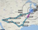
It would look something like this, though we’d probably go KATS-KABQ instead of the southern route past Phoenix:
49A328D7-C571-4BAC-A6C6-171EB4529AF6.jpeg
 
The weather in AZ that time of year (late September) is generally excellent. Monsoon is normally over by then. I'd say flying doesn't need to be limited to morning hours either. Forecasts are generally pretty accurate.

The biggest weather threat can be remnants of tropical storms or hurricanes coming up from Mexico and Gulf of California. The bad weather can linger for a couple of days. But even then, it's usually forecasted well in advance.
 
I can't speak to the weather in AZ but unless you're meeting friends or something there isn't crap going on in KARG.
 
Planning a late September trip to AZ, NM, and TX. Target is a friend’s wedding in Sedona, and visiting friends & relatives in southeastern NM (KATS), and a bunch of Texas stops (San Antonio, College Station, Houston, Dallas, and Longview).

Not sure if we should do the wedding first with a long boring flight until nearing Albuquerque, or do the Texas visits first and hit the wedding last. Thinking that headwinds time on short hops TX to NM to AZ will be less annoying, and we can catch tailwinds AZ to IN. We would also have a built in time cushion to cancel some of the TX stops to make up time we lose due to weather.

I’ve read about flying early due to turbulence. I also understand some days can also be very windy.

My question: What weather should I expect in AZ that time of year, generally? Will I be able plan a few days in advance with weather briefings, or is it a crapshoot? We can always leave the plane short and drive/fly commercial for the wedding. Trying to figure out if we should do the wedding first if the weather looks fabulous.

Taking a wait & see attitude for now, checking weather there for practice.

It would look something like this, though we’d probably go KATS-KABQ instead of the southern route past Phoenix:
View attachment 119826
You're in for a treat!

I did a very similar flight last year, except in October instead of September. I have a little writeup on POA here. Did another one this past May/June documented here. Chicago was my departure point and Phoenix was my final stop for both.

AZ had no wx system curveballs at all. The progs and TAFs were spot on for me. DA ended up being the only factor to consider.

West Texas and eastern New Mexico were decidedly not like that. Both times I went through KAMA the winds were intense and KROW was even worse (35kts, 42kts respectively). Had to do my first go-around as a PPL down there.

Turbulence was a total non-event on both legs of the trip in October even flying mid-day, but I wish it would have been so I wasn't over-confident flying mid-day this year. Because in May/June I flew out mid-morning/early afternoon and the turbulence was A-W-F-U-L. Experienced it from 100nm east of El Paso all the way to touchdown in Phoenix. I thanked god I didn't have passengers or they would have never flown with me again and probably barfed all over my interior. I hope your experience is more like my October flight.

If your trip is anything like mine the hardest part, weather wise, will be in west Texas. I wrote about that in my May/June debrief. Everyday Texas seems to cook up some fresh bull**** to throw at you. The TAFs routinely call for storms and variable winds at 30+ knots, only to end up being either: a gentle breeze with VFR conditions OR... variable at 30+ knots and MVFR or worse. My experience was that a lot of the weather doesn't come to pass or exists only in little isolated cells that can be safely navigated around (with caution). But I only have a couple of weeks of data-points operating in that area. I think it's just hard wx to predict. I'd make a habit of routinely checking Texas TAFs and TAF discussions prior to flying, especially KAMA/Lubbock/Odessa/Abilene just so you can get a feel about how that weather is forecasted and plays out. It's not quite like the midwest. In Chicago when it says "THUNDERSTORM" in the TAF or "winds variable at 30knots", I can be confident that it's a bad day for flying. In TX, it's harder to tell.

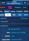
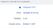
For instance, this was my TAF at Amarillo which ended up not coming true at all -- winds ended up being like 10 knots on the METAR and pure VFR (ticked me off since I relied on it and was cooling my heels in Roswell for an extra 2 days). When I finally did fly out it was forecasted VFR and ended up MVFR with crazy wind. Go figure. And below is the current TAF for El Paso. You see storms+variable/strong wind as a near permanent fixture on their TAFs :p. I did not get to go a single day without seeing thunderstorms mentioned in their TAF discussions.
1692084588810.png
1692085042890.png

Only recommendation is KODO instead of KMAF. Cheaper gas. 3 runways so wind can't be an issue. And TexasAero took good care of me with a hangar and inexpensive fuel. Also, be cautious about flying at night time. It gets *really* dark from KROW->KELP->LRU/DMN. Not a whole lot of lights on the ground for horizon, feels like IFR. Concerned me a lot on the first trip.

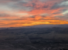
Be sure to take lots of photos and do a debrief on PoA. And be sure to carve out at least one night to fly at sunset in NM+AZ because it's just unreal... No camera can replicate the views you get out there. Enjoy!

1692083170475.png
 
Not sure how you chose your stops in Texas (friends/family? business? heard about stuff to do?), but if you've chosen them for enjoyment alone I'd suggest trading Austin for Longview and/or College Station, as it's a bigger town with more to see/do/eat. Also, you mentioned Dallas as a stop but didn't show it on your flight plan graphic. fwiw.

If you have any interest in caverns, I would suggest a stop at Sonora, TX to see the Caverns of Sonora. They're out in the middle of nowhere so it's not easy to combine them with other stuff, but your notional plan isn't too far away from them. They are spectacular. Carlsbad, which is also in the region and far more famous, is faaaar larger. But Sonora is more beautiful. (Ground transportation may be a challenge, so make sure you have a plan for that before you schedule it in. Last time I went, the airport had a courtesy van, but that was about five years ago. Before that, there was no taxi, Uber, or car rental in town; not sure what it's like now.)
 
I can't speak to the weather in AZ but unless you're meeting friends or something there isn't crap going on in KARG.
Ice cream :biggrin:

KARG is usually a halfway stop for me when I go to KGGG (with basically nothing there, as you said).
 
Not sure how you chose your stops in Texas (friends/family? business? heard about stuff to do?), but if you've chosen them for enjoyment alone I'd suggest trading Austin for Longview and/or College Station, as it's a bigger town with more to see/do/eat. Also, you mentioned Dallas as a stop but didn't show it on your flight plan graphic. fwiw.

If you have any interest in caverns, I would suggest a stop at Sonora, TX to see the Caverns of Sonora. They're out in the middle of nowhere so it's not easy to combine them with other stuff, but your notional plan isn't too far away from them. They are spectacular. Carlsbad, which is also in the region and far more famous, is faaaar larger. But Sonora is more beautiful. (Ground transportation may be a challenge, so make sure you have a plan for that before you schedule it in. Last time I went, the airport had a courtesy van, but that was about five years ago. Before that, there was no taxi, Uber, or car rental in town; not sure what it's like now.)
Thanks. The TX stops are family, friends, fuel.
 
Do the wedding first assuming you have clothes just for that. It's hot and dusty in a lot of that area. Then you don't have to worry about getting them cleaned or ironed before. BTDT. Also, if you position flying to the wedding as positive, be sure and take the hanging bag with SWMBO's dress in it out of the car as part of your preflight (ask me how I know).
 
Just a few smaller comments:

1) I’m a big fan of KPCD south of St Louis, if you only need a fuel stop.
2) if you return through Arkansas at the very end of September, we host a real fun fly-in at 3M0 (Gaston’s) https://www.pilotsofamerica.com/community/threads/annual-gastons-fly-in-gaston’s-sep-29-oct-1-2023-3m0-or-kbpk.142618/
 
Update: decided to do a clockwise trip. Leaving this Saturday Sept 16. KGGG Longview, TX as our first stay. Probably stop at M70 Pocahontas, AR for some lunch.

Might need to either wait out some weather at KGGG or just leave home a little later. Long range weather planning is always a bit involved, but doing multiple legs over 2 weeks, plus unfamiliarity with regional weather adds a lot of complexity. Up to now have only done about a half dozen single day XC flights crossing 500-750nm, then back on a different day.

Hopefully we won’t have too many visits cancelled due to weather. Statistically we probably will.

Here are the current plans for overnight or day stops:
Waco, TX
College Station
Houston (KDWH)
Nearest field to Flatonia, TX
San Antonio
Odessa/Midland
Artesia, NM
Albuquerque, NM
Sedona, AZ

Then home by tailwinds, with a short stop in El Dorado, KS to get a quick canard inspection at Peterson’s Performance Plus

The west TX, NM, and AZ segments will have some rest stops, as will the trip home with probably an overnight. 10 places, most overnight, 16-18 days in total.

Thanks again for everyone’s help and input.
 
I assume this is a VFR trip. Some general comments gained from some long, solo, VFR XCs.

Do not push the weather. I've been weathered-in on every long XC I've ever taken. I had a 3 day flight last 11 days. I spent 4 days in Medford, OR waiting for a weather window. Other places I've been stuck for various amounts of time, Hays,KS, Grant,NE, Bozeman,MT, Klamath Falls,OR, Hillsboro,OR, Ellensburg,WA, Knoxville,TN, Hondo,TX, ...

Do not push your physical limits. If you are tired/weary/burned out/whatever, stay on the ground. I needed a 3 day rest in Deming, NM of all places. I was physically and emotionally beat visiting dying friends.
 
KCLL (College Station) has a great restaurant on field...Gate 12. If you find yourself in that neck of the woods and need a lunch or dinner spot, I could not suggest better. The tower is great and the shuttle will bring you from your plane to the FBO and a short walk to Gate 12.
 
First day, KLAF-M70-KGGG. Filed IFR both legs. 6k first, 8k next to get above bumps. Cloud bases were around 9-10k, so kept visual the whole way. About 15 minutes of light rain. Was wondering if KGGG was going to be stormed in, but the mess stayed 50 nm south.

Stopped at M70 Pocahontas AR, as a halfway point to refuel and eat. Cheap fuel. Great BBQ shack next door (Greene’s Beans Buns and BBQ). The FBO is new and has all the amenities. I normally stop at KARG for the cheap fuel and free ice-cream, so this was a nice change of pace.

KGGG FBO KRS was pleasant as always. Tie downs were full, so $75/day hangar it is. Got a guided tour of this single purpose built Viking!

040A4B29-78B8-4B4F-B3AE-C742942229C1.jpeg
 
Today was a morning flight from KGGG to KCLL. Fueled up at KGGG cuz it was $1 cheaper than our next 2 stops.

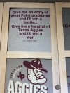
Gig ‘em Aggies! My alma mater. Had fun with old friends that are now locals. Lunch at Double Daves - pizza rolls of course. I remember the location next to campus had a drink-your-way-around-the-world with like 100 beers and a punch card. We heard The Dixie Chicken was closed due to a fire and hasn’t reopened yet. I guess Dudley’s Draw is no more either. And we remembered long-gone Tom’s BBQ. We could hardly recognize campus or the town. School was 40k students when we went there.

Night flight, VFR, 4,500 from KCLL to KACT (Waco). KCLL was crazy busy at 8:30p. KACT was crazy busy at 9:30p. Staying with relatives for a couple days, then off to Houston’s KDWH (Hooks Airport).

I guess I am now committed to doing this as a record of my trip for myself. I hope this is ok with most of y’all. I’ll find a nice aviation pic or two to stick in here later, but for now:

E7A38AAF-6B6D-4D27-9346-51F744E9FBC4.jpeg
 
Here is an obligatory pic I promised:

627A4533-41A6-437E-A582-1A08E5BE9B48.jpeg

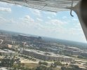
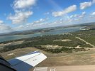
We flew Waco to KDWH in northwest Houston. Went ahead and got flight following, since they offered it up. Didn’t want to bother since we wanted to divert a bit east for a few more photos of the Texas A&M campus, but ATC was super accommodating.

Just off of KACT Waco
D3931956-24B5-4C3B-BACC-2E99DF346CC5.jpeg

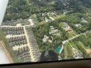
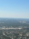
Mansions and tract homes on approach to KDWH Houston:
01B13857-D157-44D9-8101-3E5E8A90C4E2.jpeg
KDWH was such a cool busy airport. Lots of activity. Friendly staff at the FBO. Good fuel prices.

Stayed with friends. Caught a Friday night HS football game. Huge school. Band has a semi and another smaller truck.

2 Whataburger meals, 2 BBQ meals, and a bunch of Mexican food to get our fill before going home next week.

Then came to San Antonio…
 
Last edited:
Leaving KSWH Houston approach kept us low out of Bravo and maneuvered to avoid other traffic. Couldn’t wait to climb.

Fairly boring flight. San Antonio approach started maneuvering us between jet traffic. We followed an Airbus in per ATC. I’m mad at myself for landing too fast. Did 3 landings all in one go, and lost sight of crosswind correction at the end not happy, but you slice one every once in a while.

Airbus:
3B29EE04-2287-4E35-92BE-3545673A5D01.jpeg

1ACB2EAF-6E6E-4732-BA98-D18417E7A033.jpeg
 
Any words of wisdom for going from Artesia, NM to Sedona, AZ?

I was planning to go northwest towards Albuquerque then west to Sedona. I want to keep altitudes somewhat sane. Thinking 12k MSL will keep us clear and roughly 3-4k AGL most of the way.

I might need to refill O2 on the way home because we are going to try an early morning Grand Canyon flight that I hadn’t planned until we started our trip.
 
I was planning to go northwest towards Albuquerque then west to Sedona. I want to keep altitudes somewhat sane. Thinking 12k MSL will keep us clear and roughly 3-4k AGL most of the way.

I've flown that route from Cavern City to Albuquerque staying at or above the MEAs. 12K should be fine unless the headwinds aloft are excessive and you get irritated with your groundspeed.
 
So did the trip from KSAT (San Antonio) to KODO (Odessa). Very nice FBO and crew cars.

B409B963-6580-4FB0-AE6D-BAE68F5BF23A.jpeg

Surprised my wife’s aunt at lunch who had been released from the hospital a week earlier.

Decided to add some fuel for 2 reasons - (1) in case we needed to divert due to impending storms, and (2) to get a “feel” for high density altitude takeoffs and landings on later legs.
 
KODO to KATS (Artesia, NM)

We had been watching storms developing west of Artesia, but seeming somewhat stalled and dissipating in some areas, strengthening in others. But slow moving.

So we launched.

On takeoff at Odessa DA was about 5,500 ft. Longer takeoff roll - plane came off the ground in my typical soft-field fashion, but the ground effect took longer to build up the speed. I was leaned out slightly less than my low altitude cruise.

We left at about 3p. Not our best idea to fly in the afternoon. It was bumpy all the way up at 8,500.

About 30 minutes into the 1 hour flight I was starting to question if we would make our destination. We had a storm to our 9 o’clock, one about 2 o’clock, and one dead ahead. I was looking up more than down, and kept looking backwards to make sure we had outs. Sun was still visible overhead, so we were never under any anvils or cloud cover, but had to manuever slightly to make sure. At one point we were probably a little too close to the 9 o’clock storm, so I veered a bit east.

I have ADSB-in, but knowing it’s a delayed picture. I also have a storm scope that was showing lightning strikes 50-100 nm ahead. (I’ve used it twice for fun in the last 5-6 years, but never for tactical decisions; I was going to remove it for an avionics upgrade, but now I’m keeping it). Our destination was 50 miles ahead.

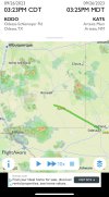
I figured we had a lot of other options, but let’s try something. Used the NRST function of my GPS to find the closest FSS frequency - Albuquerque. Called em up. Told them my eyeball, ADSB, and scope indications and asked them what they were seeing. SUPER helpful. They reported the storms were moving at 5mph, with 1” hail. So we could get in - but then what about hangar…

Landing at KATS made up for my crummy landing at KSAT. Runway 13, winds 170 at 14 gusting 20. Felt good and it was nice to be on the ground.

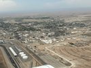
Artesia view looking northwest:
40AAB786-EC57-48AF-A849-201A02C4CE72.jpeg2BF8D96C-C40D-47CD-9889-F40A496974C0.jpeg
 
We are now considering driving from here to Sedona. We were going to depart Artesia tomorrow morning (Thursday) and arrive Sedona around noon. I had a plan to fly the grand Canyon Friday morning. The wedding is Saturday, then start our easterly trek back on Sunday. I am concerned with being stuck there due to forecasted winds in a mountain environment. Winds 20 gusting to 30 is ok with me in my Midwest home, but I am new to high DA and mountains. I’m thinking no-go.

Any opinions?
 
KODO to KATS (Artesia, NM)

We had been watching storms developing west of Artesia, but seeming somewhat stalled and dissipating in some areas, strengthening in others. But slow moving.

So we launched.

On takeoff at Odessa DA was about 5,500 ft. Longer takeoff roll - plane came off the ground in my typical soft-field fashion, but the ground effect took longer to build up the speed. I was leaned out slightly less than my low altitude cruise.

We left at about 3p. Not our best idea to fly in the afternoon. It was bumpy all the way up at 8,500.

About 30 minutes into the 1 hour flight I was starting to question if we would make our destination. We had a storm to our 9 o’clock, one about 2 o’clock, and one dead ahead. I was looking up more than down, and kept looking backwards to make sure we had outs. Sun was still visible overhead, so we were never under any anvils or cloud cover, but had to manuever slightly to make sure. At one point we were probably a little too close to the 9 o’clock storm, so I veered a bit east.

I have ADSB-in, but knowing it’s a delayed picture. I also have a storm scope that was showing lightning strikes 50-100 nm ahead. (I’ve used it twice for fun in the last 5-6 years, but never for tactical decisions; I was going to remove it for an avionics upgrade, but now I’m keeping it). Our destination was 50 miles ahead.

I figured we had a lot of other options, but let’s try something. Used the NRST function of my GPS to find the closest FSS frequency - Albuquerque. Called em up. Told them my eyeball, ADSB, and scope indications and asked them what they were seeing. SUPER helpful. They reported the storms were moving at 5mph, with 1” hail. So we could get in - but then what about hangar…

Landing at KATS made up for my crummy landing at KSAT. Runway 13, winds 170 at 14 gusting 20. Felt good and it was nice to be on the ground.

Artesia view looking northwest:
View attachment 120906View attachment 120908
Glad you stopped at KODO. Substantially cheaper than the next door Charlie airfield. That fun scattered, slow-moving storm-cell weather experience is exactly what I'd observed and wrote about in my long-winded wx monologue :D, it's a bit different from our midwest stuff. Glad you maneuvered around the storms and had a second pair of eyes from flight service!

Re your flight to AZ... It seems like you could at least get to the phoenix area without wx trouble (taking I-10 route to KATS -> EWM -> LRU -> SSO -> TUS -> PHX is my path). A car ride to Sedona might be prudent if you're uncomfortable with forecasted winds there, but that's much shorter than driving all the way from KATS. If you've experienced a bit of bumpy turbulence I'd recommend leaving in the AM. It made a world of difference for me.

Thank you. Taking the south route to Phoenix and driving seems like a better alternative.

I’m starting to see MVFR smoke in the forecasts, plus winds aloft at 12k over 20 kt so even getting to KSEZ might not be prudent, let alone getting “stuck” there.
 
Thanks to everyone, and especially @ArrowFlyer86 for the last minute save!

We took the southern route. I was feeling cheated before this morning’s flight, but actually got enough of a taste flying over a bit of terrain. I also think there were more options in an emergency scenario.

First leg was KATS Artesia, NM to KLSB Lordsburg, NM. I had mentioned casually the afternoon before to the FBO employee at KATS that I wanted topped off with fuel. It was closing time and he said he’d do it first thing when they opened in the morning. I say “casually” because that’s my habit with cross-countries lowlands/flatlands. I realized it later that evening and needed to get to the airport early to take less fuel and leave earlier for DA.

Met a guy who was flying a recently purchased Piper Cub from Arkansas to California. He said 12 gallon tank at 4 gph and 50 mph ground speed. His dad bought it at age 90 (not with him on this trip). He was flight planning with paper charts. Old-school as it gets. He had ForeFlight on his phone but was having problems with flight tracking. I showed him a few tricks. He said it was comical when he lost his chart out the window trying to fly with one hand and use the phone with the other. Flying at 2,000 agl. But I digress. Made our trip and my chariot look luxurious (it IS nice, lol).

I learned the night before that there was a presidential TFR in Phoenix. I decided for leg 1 that we would fly without flight following; we’d file IFR on leg 2. Beautiful scenery. Desolate in places. Amazing that some people live so remotely from towns.

I switched to approach frequency north of El Paso for about 2 minutes and decided I didn’t want to disturb the peacefulness of the Io-470 drone; switched back to an unused freq (monitoring 121.5).

The El Paso area was a lot different than I expected from perusing the sectional. Kinda cool. Got a notice on my phone from Verizon that said “Welcome to Mexico”, lol.

KLSB Lordsburg FBO manager Fritz was a memorable friendly guy. We stopped due to good reviews. He helped us fuel, offered to take us to town for food. Glad we stopped here. This stop was right around the halfway point.

Realized after we landed that we’d be dealing with a 5,000 ft runway and DA was approaching 6,400. I gotta get used to DA considerations - it’s not drilled into us midwest pilots. I thought about sticking around a while, but thought better of it. Takeoff roll was long, but fine. No real terrain or obstacles to worry about. (The faster ground speed of the landing was really noticeable).

Leg 2 was KLSB to KGYR Goodyear. Filed IFR because of the TFR. Got my most complicated route clearance ever (not terrible, just 5 waypoints; realized how easy programming a newer GPS really was). Picked up my clearance in the air. Got asked if I could do 10k MSL and maintain terrain clearance.

South of Phoenix we got the descent instructions. The flight plan they gave had us flying over KPHX, but they started to vector us south. It looked like they were vectoring us into a mountain (Sierra Estrella). Once over the mountain at 6,000 they cleared us for the visual to Rwy 22. Field elevation was about 1,000. Had fun with a >2k fpm slip on the other side of the mountain. My wife asked “what was that” and said she was “hanging on” :)

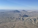
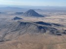
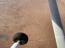
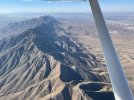
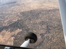
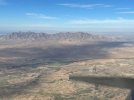
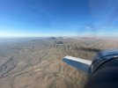
A few pics that don’t do it justice. That first pic I think is a relic volcano?
F2DD8BB9-C5C4-4C4E-90B6-93A61C0CB9B2.jpegB3C3BC9E-09C4-4E02-9F6E-D2F15B0CE4EC.jpegC5FA2CCD-87BA-4910-A824-E3025EAE72ED.jpeg3CC1F89A-338E-437B-8BC8-BB56A80A69E6.jpegB6D9F067-00F5-4D71-A7EC-52723BA6D72B.jpeg576BB1F4-315B-4A08-ADA0-778A1C6F8613.jpeg
 
Last edited:
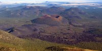
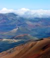
Those are cinder cones--small volcanoes. The crater of Haleakala contains numerous cinder cones.
North of Flagstaff there is also a cinder cone field.
DSC_0162.Flagstaff.Cinder.Cones.2048.JPG
 
Those are cinder cones--small volcanoes. The crater of Haleakala contains numerous cinder cones.
North of Flagstaff there is also a cinder cone field.
View attachment 120991

Do you think they are remnants of an older cinder cone? That crater pattern around it looks like it, or a possible collapse around the main shaft. It was pretty massive, hard to judge scale from my original photo. I am ashamed…I’m a geologist but the hard rock geology I learned was almost 35 years ago.

14BC6DA7-C7B0-4631-A10A-355A57E280E9.jpeg
 
Back
Top