Grand Canyon Corridors - Any CFI's?

VWGhiaBob

Line Up and Wait
Joined
Mar 17, 2013
Messages
884
Display Name

Display name:
VWGhiaBob
I would like to fly over Grand Canyon from LA area, but would like to do it the first time with a CFI experienced with the corridors and routes. Any suggestions? Are there flight schools near the canyon where I could stop and pick one up?
 
Get the Grand Canyon VFR chart, corridors are marked, GPS co-ordinates are printed there, plug them into your GPS of choice and go fly.
 
Why do you want a CFI? It isn't like flying through the LA Class B VFR corridors.

Pretty straightforward if you have the Grand Canyon VFR chart, and not much traffic.

It really is a non-event.
 
Get the Grand Canyon VFR chart, corridors are marked, GPS co-ordinates are printed there, plug them into your GPS of choice and go fly.


This. It's not rocket science.

ForeFlight even has the GCN chart.
 
It is very straightforward. If you're using FF you will be talking with LA Center. Tell them what you want to do and they will vector you. As a backup, of course, you should have the Grand Canyon Sectional and I would also create custom waypoints in your GPS or foreflight or whatever you are using for the end points of the corridors. The lat/lon coordinates are listed on the sectional. It is not complicated at all.
 
There is ONE guy in Flagstaff.

Call the only FBO. Don't expect to use their one airplane over the canyon. It's a 172M. And the field is at 7000 feet.
 
I am a CFI and I fly commercially at the canyon. I can tell you anything you want to know about the ditch. When are you coming? It will probably cost you lunch though.
 
Why do you want a CFI? It isn't like flying through the LA Class B VFR corridors.

An experienced CFI or anyone experienced for that matter could point out cool landmarks and points of interest (like where the 2 airliners ended up after slamming into each other).
 
I did a Grand Canyon flight in November of 2013 as a side trip from a family trip to Sedona. As others have said, it's not really complicated at all. The key is to get the Grand Canyon VFR chart (http://aeronav.faa.gov/content/aeronav/grand_canyon_files/Grand_Canyon_3.zip). It's got pretty much all the information you'll need. If you use the Garmin Pilot app on either the iPad or an Android device, this chart is built in and will show up when zoomed in to the appropriate area. Maybe some of the other tablet apps also have the charts built in?

I created a bunch of user way points in my 430W corresponding to the points on the chart and just flew to those.

This web page: http://www.swaviator.com/html/issueJJ99/canyon.html also has a lot of good advice about flying the Canyon.

We flew up from Sedona and started at the Eastern end of the Canyon and zig-zagged through the corridors from East to West. Lots of great scenery. The whole flight, from Sedona, to the Canyon, the Canyon tour East to West, to Grand Canyon Caverns airport (L37) , and back to Sedona took 3.5 hours.

Grand Canyon Caverns airport was interesting. I'd read somewhere that there is a restaurant on the field, so we thought we'd stop for lunch on the way back to Sedona. The field is gravel, and is somewhat soft. We landed, and started following a looong taxi route towards the restaurant. There were tall grasses and weeds brushing the bottoms of the wing tips the whole way. Got about 3/4 of the way to the restaurant, when someone came on the radio and informed us that the restaurant was closed for the season. Had to manhandle the plane around and taxi back. Got to practice some soft field work that day. Next time, I'll do more research...

When we got back to Sedona, I discovered grasses caught in the wing tip nav lights!
 
Last edited:
Last I checked FF didn't have the canyon VFR chart georeferenced as a moving map but you can download it IIRC. Is that still true?

I'm heading to Vegas in March but I'm going IFR. One of the arrivals I considered takes you right over the canyon and the other one (LUXOR2) takes you north of it IIRC. That's one way to see the canyon - assuming no IMC.
 
This. It's not rocket science.

ForeFlight even has the GCN chart.

If you can read a chart you can fly the canyon.

I did it passing through in a 207, ain't rocket surgery.
 
Last I checked FF didn't have the canyon VFR chart georeferenced as a moving map but you can download it IIRC. Is that still true?

I'm heading to Vegas in March but I'm going IFR. One of the arrivals I considered takes you right over the canyon and the other one (LUXOR2) takes you north of it IIRC. That's one way to see the canyon - assuming no IMC.


ForeFlight added the canyon chart a while back. It behaves as a TAC chart (ie shows when you zoom in).
 
ForeFlight added the canyon chart a while back. It behaves as a TAC chart (ie shows when you zoom in).

Which is trash because it's hard to get a scale reference. When you zoom out it reverts to sectional. It works but could be way better if you could view just the SFRA chart.
 
Are ya talkin' FBO vending machine chicken salad or a real sit down meal?

Well at the Grand Canyon there isn't a fbo chicken salad option so I guess we will have to go to Tusayan and I will get the local discount so that will help.
 
Thanks, all...great info. I already have the GC sectional...and Foreflight. I guess I have to learn how to program my 430's with coordinates!

Too bad they don't establish and publish known waypoints (VPL's)...would make it so much easier in the GPS.
 
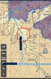
I just flew the Tuckup corridor southbound three days ago. Very easy, as described above. LA Center provides flight following through the corridors. As I was southbound from Cedar City, Center asked if I was familiar with the Grand Canyon Free Flight zones. I replied that I was planning to transit the Tuckup corridor, and all was well.

IMG_1744.JPG


One odd thing about it, though -- when flying VFR from Cedar City or St. George to Phoenix, for example, one would be at an odd+500 cruising altitude for the direction of flight. But in the Tuckup Corridor an even+500 altitude is required southbound, even though the southbound course through the corridor is 164 degrees magnetic -- which would still be odd+500 under the hemispheic rule. Thus nearly everybody going through the corridor will be going up or down a thousand feet in opposing directions just outside the boundaries of the SFRA. How is that helpful? I was at 11,500 coming down from CDC, climbed to 12,500 just to go through the corridor, then back down to 11,500 at the south end. But it's been that way since the SFRA was created, and it's not likely to change soon.

:dunno:
 
I don't want to start a new thread for this, so I'll just revive this guy..

Friend of mine landed north of Grand Canyon, headed to Phoenix from Utah. We were going to overfly one of the corridors, and I felt I did my homework. While we were at the FBO in Page, I asked them if there was any last minute gotchas I should know about overflying the canyon. They directed me to one of their pilots outside that does canyon tours. I walked up to him and asked about overflying it, and brought up the map to discuss the corridors/altitudes/comms. He said I need to be checked out by a CFI to fly the GC, even at the posted altitudes, and that if they find out we overflew it, there's people monitoring the canyon and would gladly charge us $10k if they find out we didn't adhere perfectly, or weren't checked out. On top of that, he stated the corridors aren't just straight as advertised, there's more to it, and that the CFI's would tell us all about it.

It seemed like complete nonsense, as I've talked to a CFI friend that did canyon tours and he never mentioned any of this. I've also done research on threads like this, and there's not much mention of anything other than what's on the GC VFR charts.

This guy was full of it, right?
 
Sounds like a tall tale to try and sell you on training to me.
 
I don't want to start a new thread for this, so I'll just revive this guy..

Friend of mine landed north of Grand Canyon, headed to Phoenix from Utah. We were going to overfly one of the corridors, and I felt I did my homework. While we were at the FBO in Page, I asked them if there was any last minute gotchas I should know about overflying the canyon. They directed me to one of their pilots outside that does canyon tours. I walked up to him and asked about overflying it, and brought up the map to discuss the corridors/altitudes/comms. He said I need to be checked out by a CFI to fly the GC, even at the posted altitudes, and that if they find out we overflew it, there's people monitoring the canyon and would gladly charge us $10k if they find out we didn't adhere perfectly, or weren't checked out. On top of that, he stated the corridors aren't just straight as advertised, there's more to it, and that the CFI's would tell us all about it.

It seemed like complete nonsense, as I've talked to a CFI friend that did canyon tours and he never mentioned any of this. I've also done research on threads like this, and there's not much mention of anything other than what's on the GC VFR charts.

This guy was full of it, right?

Dude wasn't just full of ****, he was overflowing with it.

Nothing in here mentions a GCNP endorsement or training.

https://www.ecfr.gov/current/title-14/chapter-I/subchapter-F/part-91/appendix-Special Federal Aviation Regulation No. 50-2

Who was going to fine you?
 
FWIW, here's the route I flew when I went a few years ago. Had the place all to myself up at the VFR overflight altitudes, but it was buzzing like a beehive with the tour ops down below. (EDIT: Interesting...my original plan included a dogleg RENTT > TUWEP > NICLE, but the copied link drops TUWEP for some reason. Maybe it was deleted since 2018?)

Definitely a life experience--highly recommended.
upload_2022-8-30_15-47-55.png
 
Last edited:
Blame me!

I think the noise I made with my Cessna 185 in 1969 was the basis of the development of the "corriders."

My frat brothers and I were returning from San Blas and came across the canyon. I dropped in over the edge and flew to Las Vegas as low As I could.

When we landed at McCarran............girls driving golf carts in bikinis parked us. Those were the days!
 
Last edited:
Pretty straight forward, I recommend doing it early in the morning to have the best ride.
 
I don't want to start a new thread for this, so I'll just revive this guy..

Friend of mine landed north of Grand Canyon, headed to Phoenix from Utah. We were going to overfly one of the corridors, and I felt I did my homework. While we were at the FBO in Page, I asked them if there was any last minute gotchas I should know about overflying the canyon. They directed me to one of their pilots outside that does canyon tours. I walked up to him and asked about overflying it, and brought up the map to discuss the corridors/altitudes/comms. He said I need to be checked out by a CFI to fly the GC, even at the posted altitudes, and that if they find out we overflew it, there's people monitoring the canyon and would gladly charge us $10k if they find out we didn't adhere perfectly, or weren't checked out. On top of that, he stated the corridors aren't just straight as advertised, there's more to it, and that the CFI's would tell us all about it.

It seemed like complete nonsense, as I've talked to a CFI friend that did canyon tours and he never mentioned any of this. I've also done research on threads like this, and there's not much mention of anything other than what's on the GC VFR charts.

This guy was full of it, right?
What he's describing is the commercial operators approved routes. Weird that this pilot would have confused those routes for the VFR corridors. Probably somebody who ended up flying a caravan over the canyon from back east somewhere and doesn't have the knowledge of vfr flying over the canyon like I imagine all pilots in the western USA have heard about.
 
This guy was full of it, right?

He was telling the truth Nathan ... he also has an uncle in Africa that is about to be arrested and they want to transmit funds to a USA account and they need YOUR help ... sounds pretty legit;):p
 
Yeah, maybe that douche was confused with some type of qualifications for the tour altitudes & any route particulars. At least that’s room for him to save a little credibility, maybe.

When I flew two corridors a few years ago it was rather quiet. There was a little going on below at the tour altitudes. I was pretty much alone at the 10.5/11.5 levels.
 
Yeah, maybe that douche was confused with some type of qualifications for the tour altitudes & any route particulars. At least that’s room for him to save a little credibility, maybe.
The pilots who fly the commercial tours have to have a line check on each of the tour routes on which he is qualified.

G.A. pilots have to stay out of the flight free zones, stay above the minimum sector altitudes, and monitor the appropriate sector frequency.

SFAR 50-2
 
I flew the canyon a few months ago during a trip to Sedona. Easiest thing I've ever done. You don't need to set up coordinates in the 430. I just set up my magenta lines through the corridors using the Foreflight machine and flew those. Make sure you're at the correct altitudes for the direction you are flying in the corridors and report your position every so often like you're in a traffic pattern. There was so little traffic I didn't even bother with flight following. Easy peasy :thumbsup:
 
I went ahead and flew it, no issues what so ever. I went ahead and radio'd in to Grand Canyon Airport and they cleared me in to specific corridors, which was a nice security blanket. Just kept on the freq's and radio'd VP's.

No $10,000 fine yet.
 
Make sure you can hit the required corridor altitudes. When I flew it back a few years, the DA was such my Warrior couldn't make the altitude. I had to be content with flying the south rim. Still ...
Photo of the GC and environs start about a third down the page:
https://www.demonick.com/flying/S43-DKX-SUA-S43/index.html
 
I was able to make the altitudes without too much problem. Made sure to leave all the luggage back at the hotel in Sedona and only had 3/4 full tanks. Plus it was in the morning and still fairly cool.
 
Reviving this for a couple of ?s


I went ahead and flew it, no issues what so ever. I went ahead and radio'd in to Grand Canyon Airport and they cleared me in to specific corridors, which was a nice security blanket. Just kept on the freq's and radio'd VP's.

No $10,000 fine yet.
One doesn’t need a clearance, correct? Just stay above the minimum sector altitude and in the corridors, fly the appropriate NB or SB altitude?

Outside the corridors- one can fly freely above the minimum sector altitude, is that right? Outside the corridors- say in between s terminus of Tuckup corridor- east of VPGCA- one could circle at 11,000 ft as one isn’t in a corridor, and is above the minimum sector altitude?
If one used supplemental o2, you could overfly the toroweap Flight free zone at 15,500?
Lastly, how does one get a paper copy of the Grand Canyon chart?
fAA has outsourced to private printers, correct? I checked the websites of all three of the “current print providers”- no joy.


IMG_8826.jpegIMG_8826.jpeg
 

Attachments

  • IMG_8827.png
    IMG_8827.png
    306.7 KB · Views: 5
Reviving this for a couple of ?s


One doesn’t need a clearance, correct? Just stay above the minimum sector altitude and in the corridors, fly the appropriate NB or SB altitude?

Outside the corridors- one can fly freely above the minimum sector altitude, is that right? Outside the corridors- say in between s terminus of Tuckup corridor- east of VPGCA- one could circle at 11,000 ft as one isn’t in a corridor, and is above the minimum sector altitude?
If one used supplemental o2, you could overfly the toroweap Flight free zone at 15,500?
Lastly, how does one get a paper copy of the Grand Canyon chart?
fAA has outsourced to private printers, correct? I checked the websites of all three of the “current print providers”- no joy.


View attachment 126303View attachment 126303
Not sure where you looked for printed charts, but Sportys has them. I'm sure other vendors do too.

 
Yes, thanks @Domenick-am specifically looking for printed chart-can no longer order them directly from FAA-sporty's has 'em-thanks!
 
Last edited:
You can even buy it on Amazon.

Grand Canyon VFR Chart

I've flown about 25 passes over the canyon on many trips back and forth to Vegas. You should really ensure your plane is running well. Losing an engine over the middle of the canyon would be a one-way trip. I like flying multiple passes east to west so you can start high and work your way lower as minimum altitudes reduce east to west. Also, watch the winds. I once tried it with >45kt winds from the south. While it's not exactly a mountain, the same effects are present. The winds swept down into the canyon on one side and up on the other, creating mountain waves and significant leeward turbulence and rollers. I had to divert after one pass as the downdrafts exceeded the climb rate of my DA40. I was full power at 10,500 at Vy and was still sinking >500fpm. On a calm day, it's absolutely a bucket list item. On a very windy day with high DA's, it's a very dangerous and not fun place to fly, with no off-field landing options.
Thanks! I’ll be in a 182 w/one passenger, in April, but of course will be mindful of DA and
winds.

Part of why I reupped this thread, is that @Nathan Hyland said he got Grand Canyon Airport gave him “clearances” into the corridors- just want to ensure I’m thinking correctly, that no clearance is needed.
 
The corridors are already marked for you if you use ForeFlight. Just follow the magenta line.
 
Back
Top