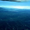
Smoky Mountains - 1A5 Macon County

Bman.

Pre-takeoff checklist
Joined
Jul 20, 2014
Messages
171
Location
Springfield, Missouri
Display Name

Display name:
Bman.
Hey all-

I am planning a potential trip over to Nantahala Outdoor Center with the family. The nearest airport is flying into 1A5 Macon County (Franklin NC). Another option is to fly into Pigeon Forge and drive in another 1.5 hours.

The wife was concerned about "mountains". While this is a beautiful range, it's not Rocky Mountains as she has made it out to be. However, it got me to thinking, what sort of training or information should I really be looking for if flying to the Smoky range? I will hit my CFII up for information but all information is great.

I will be flying my Archer PA-28-181.
I am working my way through instrument training but won't be wrapped up by the time this trip roles around in a few weeks so we will VFR in/out of the region.

http://maconcountyairport.com/learntofly.html

Thanks for the input-
Benjamin
 
Looks pretty cut and dry. The MOA is not going to be a concern for your archer. Big long runway.
Define family?? MSL is around 2K so elevation is not that crazy but if you are heavy you’ll need to think about w&b and fuel on hot humid day
 
Pigeon Forge piece of cake, Franklin has a lot of rocks around (hills, mountains) so don't go doing any scud running. They may not be the Rockies but like the Rockies, they don't give.
 
Looks pretty cut and dry. The MOA is not going to be a concern for your archer. Big long runway.
Define family?? MSL is around 2K so elevation is not that crazy but if you are heavy you’ll need to think about w&b and fuel on hot humid day

FE of 2k but surrounded by peaks up to 6,600, so your lazy fair (I DON'T SPEAK FRENCH) attitude will get u killed one day. ok that's a lil dramatic but those mountains will kick ur ass if ur not paying attention. they have prevented several trips for me, including missing a day or two of my own fly in. pigeon forge is on the FLAT LANDS on the other side of the mtns (well, other side from me), and is not comparable to flying into 1A5. although it will probably be a non-event, I would not take the planning lightly.


EDIT: I'm not talking about DA, I'm talking about winds, mostly, as well as navigating the peaks and potential clouds and wx you may encounter.
 
Last edited:
Looks pretty. Still, remarks "RAPIDLY RISING TERRAIN ALL QUADRANTS," and a quick look via Google maps/satellite looks like surrounded by a whole lot of no place to go if you needed to, for quite a ways in pretty much all directions.

I'd say don't be heavy or even very close, especially if it's warm. Guessing winds may be gusty and changeable, with all the surrounding terrain, though just a guess.
 
With proper planning it’s not too bad.

Mountain obscuration and winds are your biggest negative influence. Be prepared for wind shear and thermals anytime. No need for any mountain flying courses or anything like that IMO. The tallest point among the smokies is Clingman’s Dome which is just east of Pigeon Forge (a beautiful hiking location too btw) which stands around 6,500’. Very few places to land if the fan quit so keep that in mind too, of course if you’re flying that beauty in your avatar than that takes care of part of that concern. Stay on your toes and use good judgement and you’ll be okay.

Here’s a few photos from a couple of times I was around that area and along the Appalachian chain in general.


Here’s Clingman’s Dome/ Mt Leconte. The highest elevation in TN.
2B4AC7BB-89AC-4220-B9EA-C95974945888.jpeg
Just E of Pigeon Forge near Gatlinburg
4532C522-8826-456A-8EEE-EDCF26F0E39B.jpeg
Next two are part of the southern Appalachian chain.
9E570E69-8131-4CE8-8878-255661C2B52F.jpeg
574DC17B-D251-45B4-9AAE-9017F553882D.jpeg
 
Ther is a departure procedure that talks about staying within a few miles while you get to an elevation
 
Ther is a departure procedure that talks about staying within a few miles while you get to an elevation
I’m mostly based at KVJI (Abingdon, VA) and haven’t flown into either of the OP’s airports, but flying over and around the Appalachians a good bit, you will find of course that most airports are in valleys between mountain ridges, so circling above an airport upon departure to gain terrain clearance is a procedure well applied.
You’re right these are not the Rockies but up and downdrafts and mountain obscurations can smite thee.
 
RHP is an option if you can’t get into 1A5. The drive to Bryson City is further but a little less twisty / curvy than 1A5. RHP is also a little lower and has plenty of low ground for a SW arrival / departure. Either way, just use your usual VFR planning and you should be fine. Only caution I’d say is, it’s usually foggy in both areas in the AM and with a light civil, 15 kts surface winds would be my max.
 
Windy days and night time seem the biggest dangers flying in these hills. Wind will come over a ridge and follow the terrain down the downwind side of the hill. If you are on the downwind side of a ridge on a windy day you should expect not only turbulence but downdrafts too. I have been in downdrafts of a couple thousand FPM on very windy days out here. Night flying is dangerous because much of these hills is not developed and thus appear to just be a black hole at night. Much like a black hole, if you fly into it you will not fly out of it.
 
Thanks for the information guys - I appreciate it.

1) Watch for winds and mountain obscuration.
2) Fly in decent VFR
3) Don't fly at night

...always have an out.
Makes me a little apprehensive but sounds like adventure too.

EDIT - What do you consider "high winds" in these areas? I mean in Springfield, MO - some folks consider 15 knots high winds. Hays Kansas folk would think that's light and variable.
 
RHP is an option if you can’t get into 1A5. The drive to Bryson City is further but a little less twisty / curvy than 1A5. RHP is also a little lower and has plenty of low ground for a SW arrival / departure. Either way, just use your usual VFR planning and you should be fine. Only caution I’d say is, it’s usually foggy in both areas in the AM and with a light civil, 15 kts surface winds would be my max.

I like the RHP option. It would likely be easier to get a car rental too.
 
I like the RHP option. It would likely be easier to get a car rental too.

Never rented a car there so I’m not sure who to go with. I fly in occasionally for work (EMS) but I’m in and out in a hurry. With Harah’s Casino down the road, im sure rentals shouldn’t be a problem.
 
Thanks for the information guys - I appreciate it.

1) Watch for winds and mountain obscuration.
2) Fly in decent VFR
3) Don't fly at night

...always have an out.
Makes me a little apprehensive but sounds like adventure too.

EDIT - What do you consider "high winds" in these areas? I mean in Springfield, MO - some folks consider 15 knots high winds. Hays Kansas folk would think that's light and variable.
The wind issue is because if the way it is affected by terrain. Picture water flowing in a rocky river. The concern is rapids.

So, two issues. One is turbulence in the mountains. Mountain instructors generally recommend a max of 25 knots at pass crossing altitudes. Might be uncomfortable, but still generally safe. The second is shear and a funneling effect when tryin to approach and land. Consider the wind direction and what it is doing.

IMO, "the wife" is correct in her concern for mountains. I learned how to fly in New England and then spent 20 years flying and teaching in Colorado. Now I'm in North Carolina. I have a lot of respect for mountains of any size for the way they create their own weather. It's not just about density altitude.

BTW, I've been to the Franklin airport on the ground. I couldn't resist a visit during a business trip out there. My first impression was, "wow! A real mountain airport! I have got to fly into here!"
8A7C2E2E-65B4-4003-9B4B-26E5F83650F9.jpeg
 
Last edited:
EDIT - What do you consider "high winds" in these areas? I mean in Springfield, MO - some folks consider 15 knots high winds. Hays Kansas folk would think that's light and variable.
That depends on a combination of your experience and the capability of the aircraft you are flying. In my lancair i have gone into home airport with over 60 kt wind at ridges. When I was in our c-150 I was tremendously more conservative.

I have flown an arrow but not an archer. not sure of its climb performance. .. general rule of thumb I use is on windy days, maintain ifr mountain clearance of at least 2000 feet over the highest ridge I am approaching. don't descend until over the field. As wrbix says climb up over the field or safe ground before approaching rising terrain. depart runway facing more favorable terrain.

So what wind speed to be considered high? consider 2 speeds - field metar reports and wind speed at the ridges. field speed is similar to what you think anywhere else except there may be an increased chance of wind shear due to mountain near runway. ridges speed is less of a factor if you keep high until over the field. maybe 25 kts over the ridges as a starting point for concern.
 
Thanks for the information guys - I appreciate it.

1) Watch for winds and mountain obscuration.
2) Fly in decent VFR
3) Don't fly at night

...always have an out.
Makes me a little apprehensive but sounds like adventure too.

EDIT - What do you consider "high winds" in these areas? I mean in Springfield, MO - some folks consider 15 knots high winds. Hays Kansas folk would think that's light and variable.

Honestly, you want weather with clear below 10,000 MSL, +6 miles, and wind less than 12. But what always concerns me in that area is an engine failure over the terrain.
 
BTW, I've been to the Franklin airport on the ground. I couldn't resist a visit during a business trip out there. My first impression was, "wow! A real mountain airport! I have got to fly into here!"
View attachment 65317

Hey, let's have a meet up there this fall!

I got my license in WV, and while it is nice being back in the South, I was hooked on N. Ga. / W. NC / E. Tn. mountains before spending 9 years in WV.
 
Well - you guys have done a sufficient job putting pause on Franklin. In fact, I have a bigger problem.
It appears there are no car rental options unless you get up towards Gatlinburg Pigeon Forge area.

Sure you can fly to all of these areas... and then just stay at the airport. It's always a conundrum.
 
It appears there are no car rental options unless you get up towards Gatlinburg Pigeon Forge area.

Sure you can fly to all of these areas... and then just stay at the airport. It's always a conundrum.

Go to their website in your first post. I just did.
  • A big box says the runway extension in the name of safety is complete.
  • Courtesy cars are available. Call to discuss availability and rules, though. Overnight?
  • Click on Services up at the top.
  • Halfway down my screen, it says rental cars are available through Enterprise.
Now go travel, have fun and fly safe! No, I haven't been there yet, but it's on my list. My brother-in-law has a house in Franklin.
 
Hey, let's have a meet up there this fall!

I got my license in WV, and while it is nice being back in the South, I was hooked on N. Ga. / W. NC / E. Tn. mountains before spending 9 years in WV.
Sounds like a plan. It's a drive, but there are some pretty decent restaurants in town.
 
Well - you guys have done a sufficient job putting pause on Franklin. In fact, I have a bigger problem.
It appears there are no car rental options unless you get up towards Gatlinburg Pigeon Forge area.

Franklin isn't a big tourist area (yet, anyway). There's some top notch roads in the area, though, I ride my motorcycle near there often.
 
Back
Top