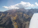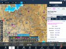
Wolf Creek Pass

Penguinforce

Pre-takeoff checklist
Joined
Oct 9, 2020
Messages
235
Location
Denver, CO
Display Name
Penguinforce
Hello everyone. I am flying down to Farmington in a couple of days to complete my checkride from the Denver area. I have had formal mountain training and have conducted several flights over the mountains in both the summer and winter, including La Veta, Loveland (over I-70), Kenosha, Vail, and Rollins pass. I may have done a couple other passes well. I have never flown Wolf Creek Pass and I know this is considered a rather difficult one. I was just looking to see any tips for flying this one. I know the general rule of thumb of go/no go when winds are above 20 knots at 12,000 or 15,000 aloft, and it’s supposed to be clear skies when I go down so I’m not too worried about running into any cloud issues. I am also prepared to take the “long way” around the mountains to get there if weather conditions are not favorable as well
 
I’ve flown Wolf Creek between Denver and Pagosa Springs/Durango, but only when clear with light winds. Otherwise, around the corner at Cumbres. What? Maybe 20 nm difference on your 240 or so nm flight?

OTOH, I don’t know what you are flying. I flew turbos on those trips.
 
I’ve flown Wolf Creek between Denver and Pagosa Springs/Durango, but only when clear with light winds. Otherwise, around the corner at Cumbres. What? Maybe 20 nm difference on your 240 or so nm flight?

OTOH, I don’t know what you are flying. I flew turbos on those trips.
That’s great advice! Just so I can plan, what would you consider light winds? I’m flying this in a piper Dakota, so not a turbo
 
I just plotted my course using Cumbres Pass. I redid my plan and charted my overall course slightly different to accommodate the new pass and it ended up only adding 6 NM to my journey. I’m definitely just going to plan Cumbres. Thanks a ton for the advice! I’m really happy I asked! :)
 
Is the juice worth the squeeze?
if you’ve flown in the Colorado Rockies, you know the answer is yes :)
I just plotted my course using Cumbres Pass. I redid my plan and charted my overall course slightly different to accommodate the new pass and it ended up only adding 6 NM to my journey. I’m definitely just going to plan Cumbres. Thanks a ton for the advice! I’m really happy I asked! :)
Hard to say. It’s been years at this point, but the last time I did it, it was, “gee it really looks nice today. I guess I’ll try Wolf Creek.” Coming down the Alamosa Valley, you reach the access point for Wolf Creek first. More, I’ll know it when I see it, than anything else. Fortunately, Wolf Creek has AWOS, right? So you can know what the actual winds are rather than a guess from the forecast winds aloft.

I’m sure we’ll get some comments from others whose experience is more current than mine.

Gosh I miss those mountains! (No, that’s some other pass).
1742007570009.png
 
Hard to say. It’s been years at this point, but the last time I did it, it was, “gee it really looks nice today. I guess I’ll try Wolf Creek.” Coming down the Alamosa Valley, you reach the access point for Wolf Creek first. More, I’ll know it when I see it, than anything else. Fortunately, Wolf Creek has AWOS, right? So you can know what the actual winds are rather than a guess from the forecast winds aloft.
That’s true. If it is really calm I’ll try it out. And that’s if the AWOS is working. I flew Rollins pass last fall and that awos just refused to work for a solid month haha
 
That’s true. If it is really calm I’ll try it out. And that’s if the AWOS is working. I flew Rollins pass last fall and that awos just refused to work for a solid month haha
Rollins/Corona AWOS rarely worked when I was there. Probably flew Rollins more than any other pass.
 
I was wondering how long it would take for this to show up...:thumbsup:
Wolf Creek Pass was on my bucket list ever since hearing that song as a kid in the 70s. I finally got to ride it in 2018, and again a few years after that. Breathtakingly beautiful country up there. Nowhere near as bad as the song makes it sound, but then we were on motorcycles.
 
I have friends and family in Farmington and Durango. Fly down a few times a year from the Canon City area. I have used both Wolf Creek and Cumbres passes many times. Wolf Creek is more direct for me and I more often go that way. I plan to use similar metrics as you -- 20kts or less wind at 12k, high ceilings, have flown in slightly higher winds a couple of times. Very rough. As previously mentioned, there is an AWOS in the pass. The high point in Wolf Creek is fairly brief (shorter than Cumbres, but higher). I usually touch oxygen altitudes for a short time there. Would suck to lose an engine at exactly the wrong time but that is true of most routes in the Rockies.
 
So why KFMN for a check ride; scheduling? I would think Denver has more examiners than the single one in FMN.

Flown Wolf Creek many times, but flying the passes with more than 20k wind (for any pass) is a no go for me. You could head down to SKX then direct FMN; adds about 30 miles.

Better yet, take your check ride on a good VFR day.
 
Last edited:
Ended up being pretty windy today but shot Cumbres pass pretty easily both ways. Not too bumpy at all. The east side of La Veta was definitely a washing machine though. But I passed my checkride and I’m back home safely. Thanks for the tip again!

So why KFMN for a check ride; scheduling? I would think Denver has more examiners than the single one in FMN.
I have reached out to many DPEs. I’ve been trying since last June to get one scheduled in the Denver area. Most DPEs don’t even return your call/email/text. Many DPEs in the Denver area now exclusively work with a single flight school. It’s such a mess of a system out here. I was at least able to call and schedule my checkride in the same day when I initially reached out. Ended up being a good ride and the examiner is fair so I’d recommend him as well
 
Ended up being pretty windy today but shot Cumbres pass pretty easily both ways. Not too bumpy at all. The east side of La Veta was definitely a washing machine though. But I passed my checkride and I’m back home safely. Thanks for the tip again!
I’ve had that experience at La Veta. It’s just that “roiling rapids” visual of the lee side of winds blowing across the pass. In our case, the winds were higher and we were enjoying the windward side updraft returning home from Santa Fe. We pulled our seat belts and harnesses tight in anticipation of the crossover. But that day, my favorite route via Mosca would have been a worse choice.

Congratulations on the checkride!
 
Possibly stupid question from a low-time pilot who does not live in the west....are there charts depicting these mountain pass routes you're referring to or are you plotting them on your own using the terrain depicted in the sectionals?
 
Possibly stupid question from a low-time pilot who does not live in the west....are there charts depicting these mountain pass routes you're referring to or are you plotting them on your own using the terrain depicted in the sectionals?

a4fbc6c475b4948d8deb7168880825ea.jpg
 
Ah, I see! Similar to the Boston helicopter routes. Thank you for that!
 
Possibly stupid question from a low-time pilot who does not live in the west....are there charts depicting these mountain pass routes you're referring to or are you plotting them on your own using the terrain depicted in the sectionals?
Colorado Div of Aeronautics has a great deal of info, check out the website

In addition to the book of every public airport, there’s a detailed map with commentary of all the passes, AWOS and cameras. Fill the form, they’ll send both for free. My tax dollars at work.
 
Colorado Div of Aeronautics has a great deal of info, check out the website

In addition to the book of every public airport, there’s a detailed map with commentary of all the passes, AWOS and cameras. Fill the form, they’ll send both for free. My tax dollars at work.

Yep. I got those when I lived in COS. I’d have to dig them out of boxes now, but great resources along with the CPA clinics which are essential in my opinion.
 
Possibly stupid question from a low-time pilot who does not live in the west....are there charts depicting these mountain pass routes you're referring to or are you plotting them on your own using the terrain depicted in the sectionals?
No stupid question in aviation. It’s always better to ask! Take advantage of other peoples knowledge and experience
 
Yep. I got those when I lived in COS. I’d have to dig them out of boxes now, but great resources along with the CPA clinics which are essential in my opinion.
Maps & books are updated & published every year. The book can be downloaded, the map used to be digital, but it's gotten HUGE! and only available on paper.
 
I am definitely a flat lander! I'm not sure how comfortable I am seeing terrain higher than my aircraft.

My only "mountain" experiences have been in the Grand Tetons of Arkansas, scarcely a mole hill compared to the Rockies. I distinctly remember being on left base for Runway 23 at KHOT staring into the hill side, and having to circle Mena for several minutes to gain enough altitude to get up and out of the valley. Outside of those experiences, all of my flying has been nicely hemmed in between the Rockies and Appalachian mountains, from Canada to the Gulf.
 
Yep. I got those when I lived in COS. I’d have to dig them out of boxes now, but great resources along with the CPA clinics which are essential in my opinion.
Colorado Pilots Mtn class is offered 3 times this year, focus in northern & middle CO.

New Mexico Pilots Assoc has similar, focus in NM & southern CO.
 
Ended up being pretty windy today but shot Cumbres pass pretty easily both ways. Not too bumpy at all. The east side of La Veta was definitely a washing machine though. But I passed my checkride and I’m back home safely. Thanks for the tip again!


I have reached out to many DPEs. I’ve been trying since last June to get one scheduled in the Denver area. Most DPEs don’t even return your call/email/text. Many DPEs in the Denver area now exclusively work with a single flight school. It’s such a mess of a system out here. I was at least able to call and schedule my checkride in the same day when I initially reached out. Ended up being a good ride and the examiner is fair so I’d recommend him as well
Drew's no longer a DPE, he's teaching CFI/CFIIs these days. (Mark & the CO people understand)

Between Independence (cirrus only) and Aspen (3 local schools - the 900# gorilla around here) it's become a real problem to get a checkride.
 
I have reached out to many DPEs. I’ve been trying since last June to get one scheduled in the Denver area. Most DPEs don’t even return your call/email/text. Many DPEs in the Denver area now exclusively work with a single flight school. It’s such a mess of a system out here. I was at least able to call and schedule my checkride in the same day when I initially reached out. Ended up being a good ride and the examiner is fair so I’d recommend him as well

That's what I figured. Congratulations.
 
Back
Top