When should TFRs stop referencing a VOR that was removed years ago?

Matthew

Touchdown! Greaser!
Joined
Apr 18, 2005
Messages
19,106
Location
kojc, kixd, k34
Display Name

Display name:
Matthew
I was looking at an outlook briefing a little while ago.

There's going to be a TFR near me, over an old Army ammunition plant.

The TFR location is:

"On the JOHNSON COUNTY VOR/DME (OJC) 285 degree radial at 13.7 nautical miles. (Latitude: 38º55'26"N, Longitude: 95º00'34"W)"

That VOR/DME was decommissioned and removed a few years ago and doesn't appear on charts anymore.

One thought is that FAA doesn't have current charts?
 
It wouldn't surprise me at all. Heck, not that long ago an ATC facility guided a plane with some sort of trouble to a non-existent (decommissioned) airfield that was now a warehouse district, because their screen showed it to be active.
 
Well.. they did give LAT/LONG for where it used to be. Seems effective enough.
 
Sounds like a reasonable excuse if you bust it. TFR is invalid because the VOR is long since gone. Could be in a warehouse, therefore, somewhere other than where it was once!
 
Well.. they did give LAT/LONG for where it used to be. Seems effective enough.
The lat/long of the VOR is useless because each VOR has its own magnetic variation and there is no way to know which direction a radial of a decommissioned VOR is supposed to refer to. However, the lat/long given appears to be for the radial/DME fix upon which the TFR is centered, so it's actually helpful. They should just give that instead. And they should use decimal minutes as that is apparently the format used in NOTAMs.
 
The lat/long of the VOR is useless...However, the lat/long... so it's actually helpful.

So is it that we should appreciate the helpful useless information? I'm cornfused.
 
So is it that we should appreciate the helpful useless information? I'm cornfused.
From the OP:
"On the JOHNSON COUNTY VOR/DME (OJC) 285 degree radial at 13.7 nautical miles. (Latitude: 38º55'26"N, Longitude: 95º00'34"W)"

I read this as meaning that the center of the TFR is at the OJC 285 radial, 13.7nm DME, and that the center of the TFR is the given latitude and longitude. So the latitude and longitude that are given in the TFR are useful. But the latitude and longitude of the VOR itself (which are not given) would be useless, because you can't just go 285 degrees (magnetic or true, both are likely wrong when dealing with VOR radials) from the VOR and measure 13.7nm to get to the designated point.
 
The lat/lon of the actual TFR are nice, if you have the ability to put them into a GPS or some other device (or look online at a graphical TFR chart.) But if you call FSS for a briefing and get the TFR info, then what? There is no VOR and no radials on the chart. That VOR was on the airport, so you could guess at the 285 radial from KOJC instead of where the OJC VOR used to be and get pretty close. It's up to 1250 AGL for a few hours, but it's over an old Army ammo storage location that's sometimes popular for photos, so someone might drop down for pix.

87490.ngsversion.1467254202958.adapt.1900.1.jpg
 
Well, it’s the FAA. What did you expect? Professionalism and an eye for safety? It’s truely amazing how some* feds will have an eye for the tiniest details in your logs and MX items. Yet they miss the BIG picture.

*fwiw there are actually a few feds who have it right, and can see the big picture with safety as a focus. Unfortunately they are grid locked and no more able to do real good than we can. They do their best while we do ours
 
Pretty much all the locals will know the area being referenced by the TFR even with the VOR being referenced, but transients might very well find themselves getting down to TPA (or staying at TPA) for one of several airports a little earlier than the should. That would put them at 1000' and inside that TFR.

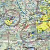
KOJC is in the lower right, that's where the OJC VOR used to be. A lot of people pop between IXD/OJC and LWC, passing right over that TFR area.

Good times.

sect_8_9653.gif
 
OJC my be decommissioned, but the navaid is still in my WingX map database.
 
Sounds like a reasonable excuse if you bust it. TFR is invalid because the VOR is long since gone. Could be in a warehouse, therefore, somewhere other than where it was once!
Yeah, I think the FAA is all into TFR busts if
Well, it’s the FAA. What did you expect? Professionalism and an eye for safety? It’s truely amazing how some* feds will have an eye for the tiniest details in your logs and MX items. Yet they miss the BIG picture.

*fwiw there are actually a few feds who have it right, and can see the big picture with safety as a focus. Unfortunately they are grid locked and no more able to do real good than we can. They do their best while we do ours
Well, as described in The Peter Principle, people are promoted until they aren't able to go higher, meaning that they are incompetent at their job. Applies more to the Feds, as it's more difficult to get fired.
 
OJC my be decommissioned, but the navaid is still in my WingX map database.
In Avair I can click on that spot and it shows radial and distance from several VORs, including OJC. It's still in some database.
 
Since no one has answered the question: "When should TFRs stop referencing a VOR that was removed years ago?"

The same day the VOR was decommissioned. :D
 
Our local VOR was decommissioned and you will still find atc try to give you a clearance to it on an IFR flight plan!! Got into a little tiff once. Gave me a clearance on ground. Told him nicely that the VOR was decommissioned a few months ago. He asks if I have a gps, I tell him I’m slant gulf. He’s ok. And just let it hang... I then have to let them know it is no longer in my database. Thing is I know the vor was out. No biggie. But what if I’m not a local. And I take that clearance.
 
The lat/long of the VOR is useless because each VOR has its own magnetic variation and there is no way to know which direction a radial of a decommissioned VOR is supposed to refer to. However, the lat/long given appears to be for the radial/DME fix upon which the TFR is centered, so it's actually helpful. They should just give that instead. And they should use decimal minutes as that is apparently the format used in NOTAMs.

That ASSUMES that you have a GPS in the aircraft. Not always a valid assumption. 3 aircraft in our club, one does not have a GPS. What would I do if I were flying that plane? No way to identify where that TFR was located.
 
That ASSUMES that you have a GPS in the aircraft. Not always a valid assumption. 3 aircraft in our club, one does not have a GPS. What would I do if I were flying that plane? No way to identify where that TFR was located.
You can plot the coordinates on a sectional and navigate around the TFR visually. The location of the TFR is important data that a radial from a decommissioned VOR cannot provide.
 
FAA is probably at the bottom of the middle-third of competency, compared to other Fed entities. Very hierarchical, very process driven, and not very capable of handling exception conditions. If you looked up a 1960's organization, viewed their org chart, took a look at their SOP - that'd be FAA.

When a function within FAA pulls off something pretty good, it's generally in spite of the "standard" behavior. Step back one level from the actual service delivery folks, and probably 30% of the staffing is redundant, or engaged in zero-to-low-value work. Doesn't mean the mid-level folks aren't working hard - they sometimes are - but competency and initiative aren't necessarily rewarded, and their is no accountability to drive efficiency or innovation.
 
You can plot the coordinates on a sectional and navigate around the TFR visually. The location of the TFR is important data that a radial from a decommissioned VOR cannot provide.

No argument there. A decommissioned VOR ranks right up there with runway behind you, altitude above you and fuel in the truck.
 
Back
Top