DaviatorSF
Pre-Flight
- Joined
- Feb 17, 2021
- Messages
- 31
- Display Name
Display name:
DaviatorSF
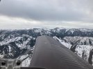
I am planning a long cross country trip for a couple of weeks from now, my first day will be KSQL to KBFF, VFR. I will need to transition the Salt Lake City Bravo airspace. I am planning to be at 11,500’ for that part of the route.
It looks like there are different east-west transition routes depending on whether KSLC is in north or south flow (which makes sense) – but there is also a note on the chart about high altitude VFR transitions using the I-80 transition at 11,500 feet eastbound.
I just want to clarify that my interpretation is correct and that I can probably count on being able to use the I-80 transition eastbound at 11.5 regardless which runways are in use at SLC.
Obviously it won’t be that hard to rejigger my flight plan if I had to use the BARN transition but it seems as if, at my altitude, that might not be necessary?
Thanks for any local advice, I always like to have an idea what to expect when that’s possible.