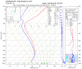
I feel like this is a dumb question, but whatever. This winter storm Flinn is about to hit so got me thinking how high you have to be to fly over it. Thunderstorm CBs can be in the 30s and 40s (and more) right? Do snow storm clouds go that high? I wouldn't think so. Are these clouds topping in the teens or 20s? I'm looking at KMCI's skew-t right now and it even looks like it is clear above 8k. Someone school me and tell me I'm stupid.
You are using an out of date browser. It may not display this or other websites correctly.
You should upgrade or use an alternative browser.
You should upgrade or use an alternative browser.
How Tall are Snow Storm Clouds
- Thread starter NealRomeoGolf
- Start date
Gilbert Buettner
Cleared for Takeoff
Usually well below 10,000, often as low as 2,000 with tops just a couple thousand above. I am not a meteorologist, so maybe one can give you a better answer. My answer is just based on experience.
Zeldman
Touchdown! Greaser!
In my experience here in New Mexico, with the bigger snow showers I usually got on top around 16,000msl. Or about 10,000agl, sometimes a couple thousand feet lower.
I have also topped out at around 2500agl with smaller snow showers. Also it seemed to me that the tops would be lower in the day than at night. Maybe my respect of the ice drove me higher at night...
The snow doesn't worry me as much as the ice did so I wanted on top of the ice.
I have also topped out at around 2500agl with smaller snow showers. Also it seemed to me that the tops would be lower in the day than at night. Maybe my respect of the ice drove me higher at night...

The snow doesn't worry me as much as the ice did so I wanted on top of the ice.
- Joined
- Dec 5, 2010
- Messages
- 5,501
- Display Name
Display name:
GeorgeC
I am not a meterologist.
Theoretically you can back out the tops from the ir satellite image.
Here's the hrrr sounding for Topeka. From my dim understanding, it's saturated and below freezing below 10k. But, the inset to the right suggests that it's still snowing above? Even if you could get on top, what happens next? The dewpoint spread isn't that much. What if it closes up?

More than 2 answers to this question.
Snow usually results from cold, dense air flowing under warm moist air, raising it until condensation occurs, as snow. Tops not very high, Warm wet air flowing over cold is the same.
"Thunder snow" results from convective activity that builds towering cumulous. Generally, lightning requires at least 20,000 feet of vertical air flow to develop. This snow may be mixed with sleet or large hailstones. A friend of mine was on a ridge in the Rockies during basic training, they were hit by thundersnow, and three of them were struck by lightning and killed. Naturally, these storms will have the same characteristics as a regular thunderstorm, but the lack of very thick layers of moist air prevents the summertime colossus. A strong wind pushing a thick layer of wet air over mountains would be the typical source of this type of snow.
Others here will doubtless inform us on other sources of snow, and how high they extend.
Edited to add, I have flown in snow at 7,500 feet over Virginia, just west of Richmond, and the reported cloud layer was at 12,000 feet. I had to descend to 3,500 feet to reach visual conditions in rain. No precipitation was in the forecast. ATC treated me very kindly, I was on Flight Following and a VFR flight plan.
EDITED again. The flight was VFR until we entered the WET snow, which destroyed visibility to the ground. The windshield was covered with a layer of snow, slowly sliding up the windshield. As long as it was sliding, the snow hitting the wing should be sliding too. Staying at that altitude was intolerable, as the temperature could cause sticking, and rapidly load the plane beyond its capability to fly.
Temperatures lower were higher, so I elected to descend into the melted snow, rain, and further to several degrees warmer. Since I was on a VFR flight plan, the controller could not "clear "my descent, but he did advise me there were no other aircraft within 25 miles as low as I was flying. I considered that as 'treating me very kindly'.
Last edited:
- Joined
- Mar 15, 2016
- Messages
- 4,903
- Display Name
Display name:
Ari
You asked it, so therefore it doesn't meet my definition of a dumb question: The one you should have asked instead of making a major life decision based on an assumption.I feel like this is a dumb question, but whatever.
The KMCI sounding looks unfriendly to me at the moment. Icy clouds up to about 8500 and then only a 1-degree temperature/dewpoint spread for a long way above that, mostly in the danger zone of -10C to 0C. In other words, if you run into a cloud below 17,000 feet, it's probably an ice factory, forming snowflakes around and on your airplane.
Someone with actual experience flying in these conditions can probably tell us more about what it's like.
Rockymountain
Pre-takeoff checklist
Scott’s answer is obviously the right one. I was going to say that the tops of Denali, K2 and Everest are covered in snow. But like Scott says it depends. Weather forecasts and pireps can give an idea of cloud tops. But not uncommon to see cloud tops up in the twenties and thirties on snow days. So have an idea of where the tops are, and how likely there is to be ice in the clouds before having Plan A, B and C being getting on top.
What happens when you’re flying in snow? Does it build up ice on your wings quickly ?More than 2 answers to this question.
Snow usually results from cold, dense air flowing under warm moist air, raising it until condensation occurs, as snow. Tops not very high, Warm wet air flowing over cold is the same.
"Thunder snow" results from convective activity that builds towering cumulous. Generally, lightning requires at least 20,000 feet of vertical air flow to develop. This snow may be mixed with sleet or large hailstones. A friend of mine was on a ridge in the Rockies during basic training, they were hit by thundersnow, and three of them were struck by lightning and killed. Naturally, these storms will have the same characteristics as a regular thunderstorm, but the lack of very thick layers of moist air prevents the summertime colossus. A strong wind pushing a thick layer of wet air over mountains would be the typical source of this type of snow.
Others here will doubtless inform us on other sources of snow, and how high they extend.
Edited to add, I have flown in snow at 7,500 feet over Virginia, just west of Richmond, and the reported cloud layer was at 12,000 feet. I had to descend to 3,500 feet to reach visual conditions in rain. No precipitation was in the forecast. ATC treated me very kindly, I was on Flight Following and a VFR flight plan.
Gilbert Buettner
Cleared for Takeoff
Depends. Wet snow can build up quickly and destroy lift and increase drag. Dry snow doesn't stick. Snow and ice are two different things. Snow adhering to the wings in flight doesn't become ice. On the ground, snow accumulating on warm wings can melt and refreeze as ice.What happens when you’re flying in snow? Does it build up ice on your wings quickly ?
