Gentlebeings...the question was asked for reasonable routes thru the Rockies. Those of us who live here, and fly here all the time, have been responding with both personal and community knowledge. Please stop trying to find "loopholes" or alternatives to our recommendations. I'm not kidding when I say CAP gets called out far too often to do aerial & ground searches for missing aircraft. Altho we allow the cadets to train for ground ops, they are NOT allowed to go on actual missions for missing aircraft.
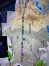
Example - last fall, a Colorado resident in a 172 who's flown 1V6-APA (Canon City to Centennial airport) frequently flew directly into the side Pikes Peak(take a look at the direct route) with passengers. I've flown the route repeatedly but never direct: 1V6-STANO-LUFSE-KAPA. This keeps me away from Colorado Springs big commercial traffic (always fun for my cherokee to be called traffic to the 737) and mostly away from the Academy traffic. The other route, and this might be what they planned to do, is 1V6-GORJE then dodge west of Pikes Peak then straight into KAPA. The Prelim NTSB report shows the crash north of Canon City on 300 heading while the route should have been further west to GORJE.
4 people in a souped-up 172, in May, daytime mid-morning.
I lived in Colorado for 35 years, the last 7 of which I was a pilot. First based out of EGE, then out of GWS, I also kept a 466 pound homebuilt on a ranch at 8000'. I flew back and forth from GWS or EGE to Minnesota several times, I also went to CLL and back in February of 2018. I did my instrument checkride in Cheyenne, and then flew down to APA to renew my medical, then over the mountains back to GWS. I flew to Idaho and back several times as well. A breakfast run was EGE to SBS, or Salida, or Buena Vista, or Leadville, of MTJ. I've flown to TEX 4 or 5 times. I did direct from EGE to GUC in the winter, highest I went was 14,700, smooth as silk even though the winds aloft forecast predicted 50kt winds.
My routes may not be approved by you, and my plane performs better than most. Loopholes as you call them, are perhaps pilots making their own decisions. While I understand giving out basic information to people unfamiliar with mountains with questionable aircraft is a good thing, there are pilots out there that can make their own decisions based on their own aircraft, knowledge and skill. I have seen it presented many times that if the winds at 12,000 are over 25kts, that you shouldn't fly a single piston over the mountains. If I held to that, I wouln't have flown very much. There is more to it than just wind speed, it matters which direction it comes from, it matters what the weather system is that is creating the wind. It also matters what direction you are going, approaching a ridge or pass from the leeward side suggests that you have your altitude long before you get to the pass, and requires you to be ready to turn around if needed.
Many times I would go direct, other times if I wasn't going far I would find a pass so I didn't have to go as high. My route to Minnesota from EGE was nearly direct, I did not cross at any specified pass. One time flying a Husky from STP to GWS, the winds on the ground at FNL were in the mid 30's, winds aloft forecast called for less than that, but I went around to the north coming back down over Walden and Rabbit Ears to EGE where the ATIS said I needed a special VFR.
Returning from CLL to EGE, I went over Canyon City, to Buena Vista, then up to Leadville. Leaving Buena Vista it was blowing 21kts straight across the runway, I got to LXV and parked it for 4 days, waiting for the continental divide to not be socked in. Left LXV with strong winds, went over Tennessee pass and down to EGE, normally I would have gone over Hagerman pass, but the divide was still looking very unfriendly.
There are many routes to fly across and in the mountains. Check the winds aloft forecast (I don't put much stock in them), check the winds on the ground at various places, check the remote sites for current weather. If on your selected route the turbulence gets bad or the conditions do not match the predicted weather, turn around.


