HPNFlyGirl
En-Route
- Joined
- Jun 9, 2005
- Messages
- 2,722
- Location
- I live in a house.
- Display Name
Display name:
iBrookieMonster
Ken Ibold said:The problem I have with it is that the maps are tiled and you can't download them in big chunks. Didn't there used to be a site where you could download an entire chart in some huge 45 MB file or something?

fgcason said:Don't even think about it if you're on dialup.
http://aviationtoolbox.org/raw_data/FAA/sectionals/current/
Note there are three files associated with each one. You want to download the BIG file, the one with the color icon. It is a TIFF file, which then opens with Photoshop or other photo editing program.Arnold said:Frank, what software is required to display the charts?
That's what I was looking for. Thanks. Except I notice the "date modified" is more than a year ago.fgcason said:Don't even think about it if you're on dialup.
http://aviationtoolbox.org/raw_data/FAA/sectionals/current/
SkyHog said:Yeah, Ken, I suspect they stopped updating them a while back. That site lets you get all kinds of old charts too, if you want them, but unfortunately, the charts are all outdated now.
")
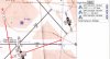
AirBaker said:Good news is, the mountains don't move much...
cherokeeflyboy said:Unless someone come along and puts up a 1500' tall Radio Tower on the peak
AirBaker said:Big sky, little tower theory?
HPNFlyGirl said:Those little towers aren't so little when you look at them from the ground.
cherokeeflyboy said:Or when you get up close and personal at 130 mph (or about 115 knots)
The Cherokee I trained in airspeed indicater is referenced to MPH, it is soooo hard for me to think in knots.
Yep, thought you knew that!! I attended his ground school at Wake Tech, joined his and San.....'s flying club, I was no longer in the flying club when i went for my check ride so I had to rent a c172R from Southern Jet at RDU. That transition as a student from a pa28-180 to a c172 about to take the ride was VERY difficult, (never could find the carb heat,) just could not think in knots . I managed to be comfortable, and signed off after about 10 hrs dual and a couple of solo x-country's I have not been in a Cessna since the following week after getting my "ticket"when I flew to Burlington to a Young Eagle Rally/ balloon Fiesta/ Air show. Logged my first flight as a certificated ( if you dont count the ride home from check ride)pilot, first passenger ,first ramp check, and first young eagle that day.HPNFlyGirl said:Did you train in Jim Du.......... plane?
cherokeeflyboy said:Yep, thought you knew that!! I attended his ground school at Wake Tech, joined his and San.....'s flying club, I was no longer in the flying club when i went for my check ride so I had to rent a c172R from Southern Jet at RDU. That transition as a student from a pa28-180 to a c172 about to take the ride was VERY difficult, (never could find the carb heat,) just could not think in knots . I managed to be comfortable, and signed off after about 10 hrs dual and a couple of solo x-country's I have not been in a Cessna since the following week after getting my "ticket"when I flew to Burlington to a Young Eagle Rally/ balloon Fiesta/ Air show. Logged my first flight as a certificated ( if you dont count the ride home from check ride)pilot, first passenger ,first ramp check, and first young eagle that day.

Hmm weird, just decided to check out the planning feature, and Skyvector doesn't seem to show me any of the charts. I am using IE6.0 sp2 here at work. anyone else having this issue?
Pete
P.S. it used to work just fine for me in the past.
Hmm weird, just decided to check out the planning feature, and Skyvector doesn't seem to show me any of the charts. I am using IE6.0 sp2 here at work. anyone else having this issue?
Pete
P.S. it used to work just fine for me in the past.
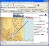
Interesting... It doesn't draw the line for me. Is there something you have to click to say "I'm finished, draw the line?"

I can't figure out how to use the PLAN function. I select the first point OK but when I try to select a second point, it just replaces the first point with the second. My "Flight Plan" always consists of just 1 point, the last one I right clicked and clicked the "PLAN" button on.
 )
)