Looooong cross country trip

ahmad

Line Up and Wait
Joined
Apr 9, 2017
Messages
505
Location
S Illinois
Display Name

Display name:
Midwest Aviator
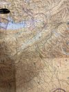
Buddy of mine purchased a C182 in Montana. The two of us will be flying it from KGPI all the way to Southern IL. He is completely relying on me to do this trip as far as planning and choosing the routes go. I have flown few hours in the mountains in CA but nothing like Montana. Plan is to go south towards MSO at 11000 ft then to HLN and BIL. We'll probably end up spending the night in Nebraska somewhere then fly home the rest of the way the next day.

Appreciate any feedback and insight about flying up there is appreciated.
Learn me.
 
South-southeast from Kalispell, over Seeley Lake, then to Helena is a good route too, no need to go all the way to Missoula.
You mention 11000. If you meant that as an IFR altitude, personally, I wouldn't go anywhere near IMC weather in that area in a182. Some of the worst icing I've ever seen has been in the Kalispell/Missoula area. Besides, you'll want to see the scenery anyway! Lots of good little stops in Nebraska for an overnight, at Valentine, the airport is close enough to town for a reasonable walk. Sounds like a great trip!

Edit: I guess the walk to town at Valentine might be 1/2 mile or a bit more.
 
Last edited:
When are you going to make the trip? I suggest bringing an oxygen bottle and two cannulas so you have more altitude flexibility to avoid icing. For what it's worth, last July I flew to KCOE and back. I went VFR, GPS direct over the mountains, and can't remember my altitudes but I tried to keep it low because we were bringing a new puppy home. The only real problem was wildfire smoke obscuring nearly all of the mountains below us.
 
South-southeast from Kalispell, over Seeley Lake, then to Helena is a good route too, no need to go all the way to Missoula.
You mention 11000. If you meant that as an IFR altitude, personally, I wouldn't go anywhere near IMC weather in that area in a182. Some of the worst icing I've ever seen has been in the Kalispell/Missoula area. Besides, you'll want to see the scenery anyway! Lots of good little stops in Nebraska for an overnight, at Valentine, the airport is close enough to town for a reasonable walk. Sounds like a great trip!

Edit: I guess the walk to town at Valentine might be 1/2 mile or a bit more.

Plan is to depart tomorrow at some point if we can. If not, we'd wait and leave whenever the conditions allow. Would prefer to stay VFR and not mess with any potential icing conditions. I figured staying on vector airways VFR would be a safe bet since neither one of us are familiar with that part of the country.
 
Knock on wood you might have lucked on weather, forecast looks pretty decent at the moment. You don't have much of a hop over the mountains from GPI heading east - rather than going too far south I'd vote to climb out of Kalispell in the morning and take a heading of roughly 117 - that'll put you over the Chinese Wall in the Bob Marshall - pretty spectacular.
If you're up for a detour from there, I'd drop down and fly low level over the Missouri River through the breaks - point towards L51. Once east of the breaks GPS direct pretty much, some cheap fuel stops in the dakotas.
Main problem is you'll get home and realize how boring the flatlands are and want to start planning your trip back.
Thank you. Appreciate it.
 
This is an easy trip for a 182, unless the winds are strong out of the west.
The valley towards Seeley lake is gorgeous. Just take that SE hen turn east. Super easy.
 
I've almost done that exact trip. It was Billings to Central IL and it was the west direction. Happy to share my routing with you. Did it in one day.
 
Watch the weather in the mountains.. then make the decision.. SE to Sealy and Billings... or slightly NE to West Glacier, Logan Pass and Saint Mary Lake to Cut Bank... once you are out of the mountains near Browning... the hard part is done. It is all weather dependent.
 
If it helps, KCII Choteau was a nice fuel stop for my trip to Idaho. It's basically the first gas station east of the mountains. So you could head that direction with a low fuel load and better performance, then gas up for the first long leg over relatively flat ground.
 
Most of the terrain is already behind you at that point. I would take off, fly to the northeast along the river and turn the corner to the south and climb over the Hungry Horse Reservoir if necessary. While the MEFs are in the mid-9000s there, the terrain that's causing that is almost at the northern edge of the sector so shouldn't be a factor. At 11,500 VFR you should be able to clear all the terrain by 3,000 feet easily. Head to GTF and pick up V120 as long as you'd like to keep you out of the MOA that it looks like they're using, and you're good.
 
I would probably go GPS direct from KBIL. I think we all have an idea of how high the terrain has to be before we fall back to airways, and it’s probably something like 2,000 feet above our home field. That being said, for your direction it might work out to use airways regardless of terrain since the MOAs are often hot during weekdays.

By the way, don’t forget the rules of conduct: Pictures or it didn’t happen. Have a safe and epic flight!
I did the airway out of BIL because of the MOAs. But not being familiar with the area, they may be cold alot. I figured they put that corridor in there for a reason so that's how I planned it when I went.

Plus sometimes it's fun to go old school for nostalgia's sake.....or something.
 
I learned to fly in Northeast Wyoming and very familiar with the area, combined with flying from SoCAL back to Wyoming I have lots of mountain avoidance experience. Once you hit Billings the terrain will be more forgiving, the only Mountians that you may cross are the Black Hills, and they are relatively tame as compared to the Rockies in Montana. Based on your plan, this should not be a hard flight at all.
 
Guessing this is the plane the OP is speaking of... At least, it's a 182 that got registered to a new owner in southern IL two days ago and is operating at GPI this morning:


Twice around the patch and landed half an hour ago, hopefully things went well and they'll be underway soon.

Edit:
Thanks for the help guys. We're heading out.
N735PS
Hah! Called it. Have a great trip!
 
I flew my 172 from Ferndale over south tip of Glacier park to ksbx. Had it over there for annual. My first trip over the mountains . We flew over upper Hungary horse coming out at Essex then to continental divide on hi way 2 . Came out south of Browning . Easy flight ,never over 7000’ . From there it’s an easy trip to Billings.
Shortest distance across mountainous terrain.
 

Attachments

  • image.jpg
    image.jpg
    3.2 MB · Views: 17
Last edited:
Screenshot_20250228_055057_Gallery.jpgScreenshot_20250228_055009_Gallery.jpgScreenshot_20250228_054938_Gallery.jpg

We made it home. One of the nicest flights I've ever done. The weather was the nicest it has been down there in a while. The friend who purchased the plane is inexperienced and was pretty much clueless about the whole thing.

The airmet tango was in effect for most of the way so I was a bit concerned. Fortunately, we experienced very little of it. Once we were half way through I saw all kinds of pireps pop up and people complaining about the turbulence. I think our timing was good. Plan was to make the trip in 2 days because my buddy didn't think he could handle such a long flight (I do 12 hrs days every few days. ha). However, I got a 6 am trip pop up(I do some part 91 work for a few owners) for today so we had to push through and get home.

The only mishap or issues experienced was my buddy forgetting and leaving his phone and wallet behind. Happened twice. Took the crew car out to lunch at KRAP. Get back and he tells me he left his wallet behind. Went and got it back. I start taxi from K89 and he says ooops I left my stuff by the fuel tanks.

We made it home safe and sound.
 
The only mishap or issues experienced was my buddy forgetting and leaving his phone and wallet behind. Happened twice. Took the crew car out to lunch at KRAP. Get back and he tells me he left his wallet behind. Went and got it back. I start taxi from K89 and he says ooops I left my stuff by the fuel tanks.
That’s the kind of mishap I like to hear about! Where did you go for lunch? And, assuming you chose correctly, did you enjoy their caramel rolls?
 
Back
Top