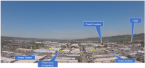
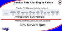
Ron, what are the options for landing straight ahead (as preached) in the event of an engine failure at take off, at this airport?
As you might guess, that preys on my mind a bit.
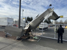
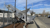
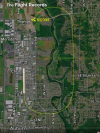
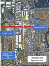
Here's a Google Earth picture of the airport and its environs. The Sonex took off on 34 (up, on the illustration). Approximate crash location is shown by the small red "X". Note that I have no insight into this accident beyond what's been on the local news.
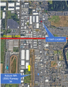
A key factor, taking off to the North, is the power lines located about a quarter mile north of the runway. These have factored into previous accidents; several times I've posted picture of a Piper that hit the lines going south and managed to land.
Anyway, when I'm taking off, it's pucker factor until I think I can clear the lines. I'll go under them if I really, REALLY have to. My airplane glides like a manhole cover.
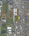
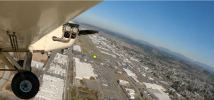
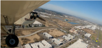
The area is mostly light industrial...warehouses, with service roads between them that aren't, generally, that busy. My own thought would be to try to set down on one of these, but of course, I've got a slow, draggy airplane. Alternatively, the roofs themselves look pretty unobstructed. I'd think I'd line up on one of the roads, and if I had to, slide over and try get an OK3 on a roof. My airplane is moderately light, but I think the local pressure will be too much and I'd expect to go through.
Beyond that, going north, you see a big asphalt parking lot on the upper left. This is a local car-auction place, and the lot is pretty full most of the time. Just south of there (across the road) is a parking lot associated with Emerald Downs Raceway. This is SOMETIMES clear, but they do like to lease it out and sometimes there are things like test tracks for local car dealers. Can't count on it, but worth a glance if the engine is acting up.
Further north, there are little tiny green belts and clear areas. Once you get about 3/4 mile north of the crash site, there' s open farmland.
I do not know if the pilot tried the "Impossible Turn". If he did, he tried to the RIGHT...which, I think, is counter-intuitive in an airplane where the pilot sits in the left seat. It'd be better visibility in a left turn.
There are open areas further east, as can be seen in the above map. I'm think it's more likely that he was trying for there, rather than a full turn-around. The Google Earth image is almost a year old, and it's not inconceivable that there's construction going on there.
Losing the engine taking off to the south is REALLY ugly. All city, to the south.
Whatever the guy did, he came out of it with just minor injuries. It's just about the best any of us could ask.
Ron Wanttaja

