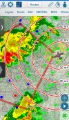
The moving map feature of EFBs requires your tablet to be GPS-capable. Virtually all smartphones and most Android tablets have GPS built-in (the new Google Pixel tablet being a notable exception). The iPads may not have GPS on-board unless you have a cellular model.
I have FltPlanGo, iFlyEFB, and DroidEFB installed on my phone and two different Samsung Android tablets. All of these work fine. Here are my thoughts based on extensive experience using all of them in real VFR or IFR:
FltPlanGo works OK, but I find the interface quite clunky. It has Canadian map coverage, if that is important. The map always starts zoomed out to geosynchronous orbit. Very annoying. It's just one of its many quirks. But it's free. For now. (Didn't Garmin swallow them up?) One plus is that it seems really good at updating and displaying ADS-B data from my NGT-9000. Seems fine for VFR.
DroidEFB is among the most intuitive and simplest Android EFBs to use. However, it has a strange mapping engine that slightly squashes maps in the N-S direction, making VOR roses not quite circular. This does not really affect its usefulness, it's just mildly annoying. Georeferenced plates are available for a little extra $$. Updates cannot be downloaded in advance, but only the day after they are issued. There is a W&B function and a basic flight planning tool that can account for winds aloft. The program comes with a Quick weather app that is very nice. The maintainers regularly update the app and are responsive to bug reports. For some reason, it is slow to download ADS-B data from my NGT-9000 via wifi. I've used this app for IFR a lot. Can be downloaded on unlimited number of devices. I've used this since it debuted.
iFlyEFB has a very nice, large UI that has a different logic than DroidEFB. It took me a while to acclimate. It runs on multiple platforms. The mapping engine is really nice, but for some reason the maintainers keep including long-expired WAC charts as the default map in the zoomed out view. A very cool feature is a glide-range ring around your plane during flight (if you put in performance data for your aircraft). Charts are geo-referenced. Updates can be downloaded when available, and can be automated. The program seems to be a little quicker extracting ADS-B data from my NGT-9000 over wifi. The flight planning tool has some nice features that accounts for altitude selection and winds aloft. There is a W&B tool as well, and a custom checklist feature. (Electronic checklists seem like gratuitous usage of technology to me. I just use a custom, laminated printed one.) I've used this app for IFR quite a bit, too. The maintainers are very responsive and continually updating the program.
I probably wouldn't use FltPlanGo for IFR. It's just too clunky for my preferences, and I found that it did not always offer all the approach charts for my home airport unless I dug deep into the menus. The first time this happened on a practice flight it threw me for a loop. Both DroidEFB and iFlyEFB are top-notch if you are in the Google ecosystem.

