Cherokee Six Down in Canada-6 fatalities

TipTanks

Pre-takeoff checklist
Joined
Mar 28, 2018
Messages
282
Display Name

Display name:
TipTanks

This one is brutal. Coming across the Rockies from Calgary area towards the BC Okanagan. 6 Young men dead, a few fathers, one father to be... has rattled the GA world up here for sure.
 
This is heart breaking. Departed Springbank Airport west of Calgary enroute to British Columbia. One father leaves a 1-year-old son, a second leaves a four-month daughter and a third leaves a son who will be born in August. Other pax. names not yet released.
PA-32 crashed and was ELT located on very remote Mount Bogart. All victims belonged to the Harvest Hills Alliance Church and were reported enroute to a church function. Weight, A/C performance and WX may be factors?
Life is fragile and sometimes it is fragile all of a sudden.
 
Loss is similar to the Yoakum TX incident earlier this year. Fathers and church leaders gone in a moment.
 
RIP

Night and mountains? No thanks.

Well, for me is more like six male adults in a (I'm assuming) normally aspirated 300hp cart. I'm more of a 100hp per adult kinda guy, though I'd be willing to lower that ratio with turbonormalizing.

For full disclosure, I already violate that in my lawnmower, which is why I don't have much interest in flying west of the Front range of CO now that the kid is over 100#. Even going-around in 5k DA with family in western KS two years ago left me rather underwhelmed from the proposition of flying all 3 of us over that side of the Country in present circumstances. It's doable, just a bit sketchy for my recreational taste anymore. Solo, sure.
I'm a PA32 driver so I get it. Wonder if they just didn't out climb the mountains or what. They didn't crash on takeoff so weight doesn't seem to be an issue. Of it were me I would've climbed over the airport before heading west. But what do I know...
 
I'm a PA32 driver so I get it. Wonder if they just didn't out climb the mountains or what. They didn't crash on takeoff so weight doesn't seem to be an issue. Of it were me I would've climbed over the airport before heading west. But what do I know...

but it's not weight, it's power loading, which is very much density altitude dependent for the powerplant. Meaning, it gets worse, not better after takeoff. Unless this was an aftermarket turbo six, at which point I stand corrected.
 
RIP

Night and mountains? No thanks.

Sunset at that location is 21:32. Accident occurred at 21:30. In the mountains it would start to get dark a bit earlier, but this was clearly not night time.
 
Didn’t look at the route or location, I see terrain was mentioned in an article. I thought it was enroute, so they got off ok.

Even in mountainous terrain there are road valleys, airways & such. If one forgets about going gps direct, there can be fairly safe options.
 
Didn’t look at the route or location, I see terrain was mentioned in an article. I thought it was enroute, so they got off ok.

Even in mountainous terrain there are road valleys, airways & such. If one forgets about going gps direct, there can be fairly safe options.
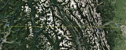
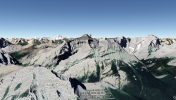
Their intended destination is in a valley; there are ways to get to it via rivers if you can afford the time. But they hit the mountain in basically a straight line course, a bit South of Canada Highway 1 by Canmore. The peaks are 8000 to 10000 ft in the area. Some climber web sites have beautiful shots of the surrounding scenery.
 
Here's the great circle route and approximate crash location (Mt Bogart) as published in the media from google earth web. The actual crash location isn't published, so that's just the marker for Mt Bogart -- not necessarily the true location. The web version of GE doesn't do elevation profiles so I couldn't show that here.

CYBW-to-CZAM.jpg
 
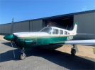
Found that the crash site is more likely on Mt McGillivray. Recent registration is C-FCCY, so a relatively new owner. You can find it by searching the Transport Canada web site for the tail number. Couldn't find any ADS-B data for the date of flight, although FlightAware shows a flight about 5 days prior with destination being Calgary.
 
They had just entered the mountainous terrain. Most likely would not have been that dark, sun had just gone down in front of them while they headed west... however there are forest fires within 200 NM of that area... which can mean haze. With the low angle of the sun combined with haze, this may have obscured mountain peaks. Speculating of course.
 
Last edited:
They had just entered the mountainous terrain. Most likely would not have been that dark, sun had just gone down behind them while they head west... however there are forest fires within 200 NM of that area... which can mean haze. With the low angle of the sun from behind combined with haze, this may have obscured mountain peaks. Speculating of course.
Sun would have been in front of the aircraft. Unless you mean behind the mountains in front of them.
 
Sun would have been in front of the aircraft. Unless you mean behind the mountains in front of them.
Sorry I mixed that up, yes... the sun would be in their eyes... same effect though if haze was present.
 
There's a thread on this here: https://www.pprune.org/accidents-cl...rcraft-kananaskis-country-alberta-canada.html

Someone posted a METAR claimed to be for their time of departure (I did not verify that's correct). Don't know if Canada pilot info is public to check if pilot was instrument rated, or to see if an IFR flight plan was filed.

FWIW, I do know that in much of Southern Canada, flight at and above 10,000 MSL requires either IFR or CVFR with ATC. Not sure if that includes the area they were in however.

METAR CYYC 290300Z 09004KT 9SM -RA BKN027 OVC039 14/11 A3028 RMK SC5SC3 PCPN VRY LGT SLP270 DENSITY ALT 3900FT=
 
Well, for me is more like six male adults in a (I'm assuming) normally aspirated 300hp cart. I'm more of a 100hp per adult kinda guy, though I'd be willing to lower that ratio with turbonormalizing.

I really like that rule of thumb, and will be stealing it. :) Thanks.
 
Aren't there mountains all the way to Vancouver?? They'd be crossing some of them in the dark, no?

That is very true, and definitely not a smart thing to be flying below mountain peaks in the dark. However, at the time of this accident, it looks like there was still daylight, so the cause is probably something else.
 
Found that the crash site is more likely on Mt McGillivray. Recent registration is C-FCCY, so a relatively new owner. You can find it by searching the Transport Canada web site for the tail number. Couldn't find any ADS-B data for the date of flight, although FlightAware shows a flight about 5 days prior with destination being Calgary.
1980 Saratoga formerly known as N716CM
 
Yeah, I had the altitude limit wrong -- it's 12,500 -- airspace above that is Class B and requires a clearance, either CVFR or IFR.But, over mountainous terrain, there's a minimum terrain clearance too, and I don't know what that is. Anyone have recent experience to chime in? I've only been in Canadian airspace back east where it pretty flat.

I do know that the highest peaks along their likely line-of-flight are right at 10K feet. I'd personally want a couple of thousand above that.
 
I do know that the highest peaks along their likely line-of-flight are right at 10K feet. I'd personally want a couple of thousand above that.
Yeah, me too.

I just found what I was looking for in terms of the legal limits of class B in Canada. It's in their "Designated Airspace Handbook", here: https://www.navcanada.ca/en/dah20230615.pdf

Their Class B starts either at 12,500 MSL (they call it ASL -- guessing thats the same as MSL?), but does not include airspace below the MEA, so over the Canadian Rockies, it probably starts higher than 12,500 in many areas.
 
Last edited:
In Canada it's 10,000 without oxygen for extended periods. One can go to 12.5K for 30 minutes without O2.

The airplane hit Mount Bogart, about eight miles south of a direct line between Springbank (departure) and Salmon Arm (destination). Bogart is 10,315' ASL and is about 40 miles WSW of Springbank. They might have still been climbing.

1691105975117.png
 
I'm trying to find out what the weather was in the crash area at the time. METAR in Calgary was overcast 3900, and I found some past weather for Banff which is not ultra far from the site (Mt Bogart or McGillivray) that indicates cloudy conditions with light rain (link below), that's for Friday 7/28 at 9PM (21:00).

Does anyone know how to access past area forecats from NavCanada (I think they're called GFAs)? I can't figure that out. That might help confirm whether it was overcast in the mountains.

At any rate, if that was the weather, then the flight was either IFR and they were trying to climb through whatever layers existed, or VFR and perhaps trying to follow the Trans-Canada highway, staying below the ceiling. Of course, that's speculation, and I really try to do as little of that as possible, cuz it usually gets me in trouble :oops:


Banff-Wx.png
 
Here were the METARs for:

Springbank - CYBW 290300Z AUTO 10008KT 9SM FEW025 OVC042 13/12 A3027 RMK SLP268 DENSITY ALT 4200FT

Bow Valley - CWXA 290300Z AUTO 32001KT 12/11 RMK AO1 3001 SLP283 T01180109 50003

Banff- CWZG 290300Z AUTO 04004KT 13/09 RMK AO1 SLP250 T01290090 53003

Bow Valley is probably the closest to the accident site. No cloud or ceiling reporting capability, but that temp/dewpoint spread is indicative of low clouds.
 
Well, for me is more like six male adults in a (I'm assuming) normally aspirated 300hp cart. I'm more of a 100hp per adult kinda guy, though I'd be willing to lower that ratio with turbonormalizing.
Wait! I fly a C206. I weigh 170 and my wife weighs 130. It's a 300 HP normally aspirated engine but that's only for take off. Does that mean we can't carry anything else? Do I have to jettison something once I reduce power????
 
Found that the crash site is more likely on Mt McGillivray. Recent registration is C-FCCY, so a relatively new owner. You can find it by searching the Transport Canada web site for the tail number. Couldn't find any ADS-B data for the date of flight, although FlightAware shows a flight about 5 days prior with destination being Calgary.
Registered June 6. The owner is father of one of the deceased, presumably at the controls.
 
I really like that rule of thumb, and will be stealing it. :) Thanks.
Weird. I thought that's what useful load was for.

So, my Lance can carry 2 people with baggage? And my mooney was a one seater?
 
In fairness he did stipulate at night over mountains.
 
Weird. I thought that's what useful load was for.

So, my Lance can carry 2 people with baggage? And my mooney was a one seater?
Maybe he just doesn't like people...I get it!
 
Best I can make out weather at the time, is that it was probably BKN-OVC between departure and Golden, and CLR or SCT West of there, but that's far from definitive. Two images below, a map showing some points where I tried to make a stab at weather, and the max ROC table for the Saratoga at max gross. The TSB prelim report should appear on this web page, probably within a month or so: https://www.bst-tsb.gc.ca/eng/enquetes-investigations/aviation/index.html
 

Attachments

  • ROC.png
    ROC.png
    98 KB · Views: 10
  • PA32-Wx-Locations.jpg
    PA32-Wx-Locations.jpg
    539.7 KB · Views: 10
Yes, i like it as a broad-brush generalization, and it fits most of the planes I am familiar with or describes the loadout I would be comfy with.

Because aviation, I am sure there a million whatabouts.

I do 1 + HP/20 to broad-brush gph cruise fuel too when I dont want/need to think about it very hard.
 
If some of those weather observations were accurate, this plan should of been torpedoed with the preflight weather check, or even looking outside.
 
Back
Top